
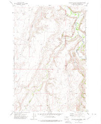
~ Spanish Coulee School MT topo map, 1:24000 scale, 7.5 X 7.5 Minute, Historical, 1971, updated 1975
Spanish Coulee School, Montana, USGS topographic map dated 1971.
Includes geographic coordinates (latitude and longitude). This topographic map is suitable for hiking, camping, and exploring, or framing it as a wall map.
Printed on-demand using high resolution imagery, on heavy weight and acid free paper, or alternatively on a variety of synthetic materials.
Topos available on paper, Waterproof, Poly, or Tyvek. Usually shipping rolled, unless combined with other folded maps in one order.
- Product Number: USGS-5398980
- Free digital map download (high-resolution, GeoPDF): Spanish Coulee School, Montana (file size: 12 MB)
- Map Size: please refer to the dimensions of the GeoPDF map above
- Weight (paper map): ca. 55 grams
- Map Type: POD USGS Topographic Map
- Map Series: HTMC
- Map Verison: Historical
- Cell ID: 42389
- Scan ID: 266825
- Imprint Year: 1975
- Woodland Tint: Yes
- Aerial Photo Year: 1970
- Field Check Year: 1971
- Datum: NAD27
- Map Projection: Lambert Conformal Conic
- Map published by United States Geological Survey
- Map Language: English
- Scanner Resolution: 600 dpi
- Map Cell Name: Spanish Coulee School
- Grid size: 7.5 X 7.5 Minute
- Date on map: 1971
- Map Scale: 1:24000
- Geographical region: Montana, United States
Neighboring Maps:
All neighboring USGS topo maps are available for sale online at a variety of scales.
Spatial coverage:
Topo map Spanish Coulee School, Montana, covers the geographical area associated the following places:
- 17N03E30____01 Well - 17N02E24D___01 Well - 17N02E02DD__01 Well - 17N03E08C___01 Well - 17N02E34A___01 Well - Leveque Reservoir Dam - Spanish Coulee School (historical) - 17N02E28B___01 Well - East Fork Spring Creek - Clark Creek - 17N02E24D___02 Well - Hound Creek School (historical) - 17N03E30____02 Well - Hound Creek - 17N03E08B___01 Well - 17N02E09D___01 Spring - Spring Creek - 17N02E34A___02 Well - Spaniard Dam - 17N02E10A___02 Well - 17N02E10A___01 Spring - Orr Post Office (historical) - Mullens Creek - West Fork Flat Creek - 17N02E09D___02 Well - Mesaros Dam - Spring Willow Coulee - 17N02E15D___01 Spring - Murphy Coulee
- Map Area ID: AREA47.2547.125-111.5-111.375
- Northwest corner Lat/Long code: USGSNW47.25-111.5
- Northeast corner Lat/Long code: USGSNE47.25-111.375
- Southwest corner Lat/Long code: USGSSW47.125-111.5
- Southeast corner Lat/Long code: USGSSE47.125-111.375
- Northern map edge Latitude: 47.25
- Southern map edge Latitude: 47.125
- Western map edge Longitude: -111.5
- Eastern map edge Longitude: -111.375


