
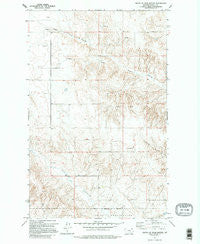
~ South of Four Buttes MT topo map, 1:24000 scale, 7.5 X 7.5 Minute, Historical, 1973, updated 1995
South of Four Buttes, Montana, USGS topographic map dated 1973.
Includes geographic coordinates (latitude and longitude). This topographic map is suitable for hiking, camping, and exploring, or framing it as a wall map.
Printed on-demand using high resolution imagery, on heavy weight and acid free paper, or alternatively on a variety of synthetic materials.
Topos available on paper, Waterproof, Poly, or Tyvek. Usually shipping rolled, unless combined with other folded maps in one order.
- Product Number: USGS-5398950
- Free digital map download (high-resolution, GeoPDF): South of Four Buttes, Montana (file size: 12 MB)
- Map Size: please refer to the dimensions of the GeoPDF map above
- Weight (paper map): ca. 55 grams
- Map Type: POD USGS Topographic Map
- Map Series: HTMC
- Map Verison: Historical
- Cell ID: 34622
- Scan ID: 266810
- Imprint Year: 1995
- Woodland Tint: Yes
- Aerial Photo Year: 1972
- Field Check Year: 1973
- Datum: NAD27
- Map Projection: Lambert Conformal Conic
- Map published by United States Geological Survey
- Map Language: English
- Scanner Resolution: 600 dpi
- Map Cell Name: South of Four Buttes
- Grid size: 7.5 X 7.5 Minute
- Date on map: 1973
- Map Scale: 1:24000
- Geographical region: Montana, United States
Neighboring Maps:
All neighboring USGS topo maps are available for sale online at a variety of scales.
Spatial coverage:
Topo map South of Four Buttes, Montana, covers the geographical area associated the following places:
- 34N47E20BAAB01 Well - 34N47E26CDAC01 Well - 34N47E20BBBD01 Well - 33N47E03BCDD01 Well - 33N47E09AAAA01 Well - 34N47E19DAAB01 Well - 34N47E20BAAC01 Well - 34N47E18DBAD01 Well - 34N47E09ADCD01 Well - 33N47E03BCDD02 Well - 34N47E27CCAD01 Well - 34N47E04DCBD01 Well - 33N47E09AADA01 Well - 34N47E17DCAA01 Well - 34N48E04BCAB01 Well - 34N47E08BDBD01 Well - 33N47E04CBBB01 Well - 34N47E36ABAC01 Well - 33N47E01DBAC01 Well
- Map Area ID: AREA48.7548.625-105.625-105.5
- Northwest corner Lat/Long code: USGSNW48.75-105.625
- Northeast corner Lat/Long code: USGSNE48.75-105.5
- Southwest corner Lat/Long code: USGSSW48.625-105.625
- Southeast corner Lat/Long code: USGSSE48.625-105.5
- Northern map edge Latitude: 48.75
- Southern map edge Latitude: 48.625
- Western map edge Longitude: -105.625
- Eastern map edge Longitude: -105.5


