
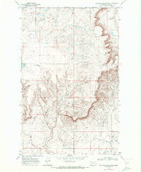
~ Mountain View School MT topo map, 1:24000 scale, 7.5 X 7.5 Minute, Historical, 1968, updated 1972
Mountain View School, Montana, USGS topographic map dated 1968.
Includes geographic coordinates (latitude and longitude). This topographic map is suitable for hiking, camping, and exploring, or framing it as a wall map.
Printed on-demand using high resolution imagery, on heavy weight and acid free paper, or alternatively on a variety of synthetic materials.
Topos available on paper, Waterproof, Poly, or Tyvek. Usually shipping rolled, unless combined with other folded maps in one order.
- Product Number: USGS-5396956
- Free digital map download (high-resolution, GeoPDF): Mountain View School, Montana (file size: 12 MB)
- Map Size: please refer to the dimensions of the GeoPDF map above
- Weight (paper map): ca. 55 grams
- Map Type: POD USGS Topographic Map
- Map Series: HTMC
- Map Verison: Historical
- Cell ID: 71002
- Scan ID: 265657
- Imprint Year: 1972
- Woodland Tint: Yes
- Aerial Photo Year: 1966
- Field Check Year: 1968
- Datum: NAD27
- Map Projection: Polyconic
- Map published by United States Geological Survey
- Map Language: English
- Scanner Resolution: 600 dpi
- Map Cell Name: Mountain View School
- Grid size: 7.5 X 7.5 Minute
- Date on map: 1968
- Map Scale: 1:24000
- Geographical region: Montana, United States
Neighboring Maps:
All neighboring USGS topo maps are available for sale online at a variety of scales.
Spatial coverage:
Topo map Mountain View School, Montana, covers the geographical area associated the following places:
- 35N04W01DB__01 Well - Frenchman Lake - Mountain View School (historical) - 36N03W32CD__01 Well - 36N03W19BB__01 Well - 36N03W30CB__01 Well - 35N04W11AA__01 Well - Benton Trail Lakes - 35N04W12BC__01 Well - 35N04W12CA__01 Well - 35N04W12CB__01 Well - 35N04W11DC__02 Well - 35N04W03AA__02 Well - 35N04W12BD__02 Well - 36N04W22AD__01 Well - 36N04W34AD__01 Well - 36N04W35AA__01 Well - 36N03W19CC__01 Well - 35N03W18CA__01 Well - 36N04W36DA__01 Well - 36N04W35AD__02 Well - 35N04W12BD__01 Well - 36N04W22DC__01 Well - 35N04W02CA__01 Well - 35N04W12CB__02 Well - 36N03W30DD__01 Well - Cowboys Lake - Foxtail Lakes - 35N04W11DC__01 Well - 36N04W35AB__01 Well - 35N04W11DD__01 Well - 36N04W25AB__01 Well - 35N04W03AA__01 Well - Kevin Sunburst Oil Field - 35N04W12BB__01 Well - 36N04W35AD__01 Well - Rocky Springs (historical)
- Map Area ID: AREA48.87548.75-112.125-112
- Northwest corner Lat/Long code: USGSNW48.875-112.125
- Northeast corner Lat/Long code: USGSNE48.875-112
- Southwest corner Lat/Long code: USGSSW48.75-112.125
- Southeast corner Lat/Long code: USGSSE48.75-112
- Northern map edge Latitude: 48.875
- Southern map edge Latitude: 48.75
- Western map edge Longitude: -112.125
- Eastern map edge Longitude: -112


