
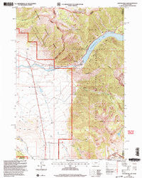
~ Earthquake Lake MT topo map, 1:24000 scale, 7.5 X 7.5 Minute, Historical, 2000, updated 2005
Earthquake Lake, Montana, USGS topographic map dated 2000.
Includes geographic coordinates (latitude and longitude). This topographic map is suitable for hiking, camping, and exploring, or framing it as a wall map.
Printed on-demand using high resolution imagery, on heavy weight and acid free paper, or alternatively on a variety of synthetic materials.
Topos available on paper, Waterproof, Poly, or Tyvek. Usually shipping rolled, unless combined with other folded maps in one order.
- Product Number: USGS-5393316
- Free digital map download (high-resolution, GeoPDF): Earthquake Lake, Montana (file size: 16 MB)
- Map Size: please refer to the dimensions of the GeoPDF map above
- Weight (paper map): ca. 55 grams
- Map Type: POD USGS Topographic Map
- Map Series: HTMC
- Map Verison: Historical
- Cell ID: 13319
- Scan ID: 263544
- Imprint Year: 2005
- Woodland Tint: Yes
- Aerial Photo Year: 1998
- Edit Year: 2000
- Datum: NAD27
- Map Projection: Lambert Conformal Conic
- Map published by United States Geological Survey
- Map published by United States Forest Service
- Map Language: English
- Scanner Resolution: 600 dpi
- Map Cell Name: Earthquake Lake
- Grid size: 7.5 X 7.5 Minute
- Date on map: 2000
- Map Scale: 1:24000
- Geographical region: Montana, United States
Neighboring Maps:
All neighboring USGS topo maps are available for sale online at a variety of scales.
Spatial coverage:
Topo map Earthquake Lake, Montana, covers the geographical area associated the following places:
- Montbestos Post Office (historical) - Madison Slide - Stagger Ranch - Earthquake Memorial - Henrys Lake Mountains - Eagle Creek - Olifee Ranch - Earthquake Lake - Rock Creek - The Horn - Slide Inn - Earthquake Lake Visitor Center - Raynolds Pass Fishing Access Site - 12S02E03ABDB01 Well - Rock Creek Campground - Sheep Mountain - Mile Creek - Earthquake Lake Dam - Little Mile Creek - Shaw Ranch - Sheep Creek - Beaver Creek Campground - Sheep Lake
- Map Area ID: AREA44.87544.75-111.5-111.375
- Northwest corner Lat/Long code: USGSNW44.875-111.5
- Northeast corner Lat/Long code: USGSNE44.875-111.375
- Southwest corner Lat/Long code: USGSSW44.75-111.5
- Southeast corner Lat/Long code: USGSSE44.75-111.375
- Northern map edge Latitude: 44.875
- Southern map edge Latitude: 44.75
- Western map edge Longitude: -111.5
- Eastern map edge Longitude: -111.375


