
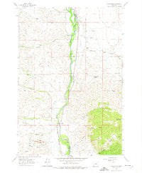
~ Earls Gulch MT topo map, 1:24000 scale, 7.5 X 7.5 Minute, Historical, 1961, updated 1974
Earls Gulch, Montana, USGS topographic map dated 1961.
Includes geographic coordinates (latitude and longitude). This topographic map is suitable for hiking, camping, and exploring, or framing it as a wall map.
Printed on-demand using high resolution imagery, on heavy weight and acid free paper, or alternatively on a variety of synthetic materials.
Topos available on paper, Waterproof, Poly, or Tyvek. Usually shipping rolled, unless combined with other folded maps in one order.
- Product Number: USGS-5393308
- Free digital map download (high-resolution, GeoPDF): Earls Gulch, Montana (file size: 11 MB)
- Map Size: please refer to the dimensions of the GeoPDF map above
- Weight (paper map): ca. 55 grams
- Map Type: POD USGS Topographic Map
- Map Series: HTMC
- Map Verison: Historical
- Cell ID: 13309
- Scan ID: 263540
- Imprint Year: 1974
- Woodland Tint: Yes
- Aerial Photo Year: 1956
- Field Check Year: 1961
- Datum: NAD27
- Map Projection: Polyconic
- Map published by United States Geological Survey
- Map Language: English
- Scanner Resolution: 600 dpi
- Map Cell Name: Earls Gulch
- Grid size: 7.5 X 7.5 Minute
- Date on map: 1961
- Map Scale: 1:24000
- Geographical region: Montana, United States
Neighboring Maps:
All neighboring USGS topo maps are available for sale online at a variety of scales.
Spatial coverage:
Topo map Earls Gulch, Montana, covers the geographical area associated the following places:
- Iron Canyon - Kalsta Ditch - Darling Post Office (historical) - Schuetz Ranch - Browns Stage Station (historical) - Dry Timber Gulch - Kalsta Ranch - McCartney Creek - Breeden Ranch - Salmon Fly Fishing Access Site - Rieber Ranch - Brownes Bridge Historical Marker - Camp Creek - Kambich Springs - Grose Ranch - Trapper Creek - Streb Ditch - Leavitt Ditch - Seven Springs - Interchange 85 - Rock Creek - Brownes Gulch - Brownes Bridge Fishing Access - Earls Gulch - Earle (historical) - McCartney Mountain - Devils Dancehall - Brownes Bridge Fishing Access Site - Corning Ranch - Tungsten Mill - Frame Ranch - Cottonwood Spring - Kambich Ranch - Browns (historical) - McCullough Ranch - Brownes Creek - Kalsta Bridge Fishing Access Site - Lavon (historical) - Pendergast Ditch - Big Hole River Bridge - Gallagher Ditch - Short Line Park (historical) - Sassman Gulch - Cherry Creek
- Map Area ID: AREA45.62545.5-112.75-112.625
- Northwest corner Lat/Long code: USGSNW45.625-112.75
- Northeast corner Lat/Long code: USGSNE45.625-112.625
- Southwest corner Lat/Long code: USGSSW45.5-112.75
- Southeast corner Lat/Long code: USGSSE45.5-112.625
- Northern map edge Latitude: 45.625
- Southern map edge Latitude: 45.5
- Western map edge Longitude: -112.75
- Eastern map edge Longitude: -112.625


