
~ Crow Creek Falls MT topo map, 1:24000 scale, 7.5 X 7.5 Minute, Historical, 2001, updated 2004
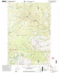
Crow Creek Falls, Montana, USGS topographic map dated 2001.
Includes geographic coordinates (latitude and longitude). This topographic map is suitable for hiking, camping, and exploring, or framing it as a wall map.
Printed on-demand using high resolution imagery, on heavy weight and acid free paper, or alternatively on a variety of synthetic materials.
Topos available on paper, Waterproof, Poly, or Tyvek. Usually shipping rolled, unless combined with other folded maps in one order.
- Product Number: USGS-5392794
- Free digital map download (high-resolution, GeoPDF): Crow Creek Falls, Montana (file size: 15 MB)
- Map Size: please refer to the dimensions of the GeoPDF map above
- Weight (paper map): ca. 55 grams
- Map Type: POD USGS Topographic Map
- Map Series: HTMC
- Map Verison: Historical
- Cell ID: 10856
- Scan ID: 263239
- Imprint Year: 2004
- Woodland Tint: Yes
- Aerial Photo Year: 1995
- Edit Year: 2001
- Datum: NAD27
- Map Projection: Lambert Conformal Conic
- Map published by United States Geological Survey
- Map published by United States Forest Service
- Map Language: English
- Scanner Resolution: 600 dpi
- Map Cell Name: Crow Creek Falls
- Grid size: 7.5 X 7.5 Minute
- Date on map: 2001
- Map Scale: 1:24000
- Geographical region: Montana, United States
Neighboring Maps:
All neighboring USGS topo maps are available for sale online at a variety of scales.
Spatial coverage:
Topo map Crow Creek Falls, Montana, covers the geographical area associated the following places:
- Little Tizer Creek - Blacker Creek - Crazy Creek - Eureka Creek - Swamp Creek Spring - Bonanza Mine - Spring Creek - Hall Creek - Longfellow Creek - Hog Hollow Mine - Slim Sam Basin - Teakettle Creek - Big Tizer Creek - Bear Gulch - Poe Park - South Fork Lakes - Hog Hollow Spring - Two Sam Spring - Gold Dust Post Office (historical) - Manley Park - Warner Creek - Bonanza Mine - Pataloma Mine - Bonanza Spring - Bomar Spring - Falls Creek - Wilson Creek - Big Tizer Wildcat Mine - Calahan Mine - Tizer Ranger Station - Ballard Mine - Gold Dust (historical) - Hog Hollow - Swamp Creek - Clear Creek - Little Tizer Wildcat Mine - Crow Creek Falls - Ballard Mine - Boulaway Mine - Golden Age Mine - Bonanza Ridge - Moose Creek - Calahan/Pataloma Mine - Dewey Creek - Longfellow Park - Eagle Creek - NE NE Section 3 Mine - Church Spring
- Map Area ID: AREA46.37546.25-111.875-111.75
- Northwest corner Lat/Long code: USGSNW46.375-111.875
- Northeast corner Lat/Long code: USGSNE46.375-111.75
- Southwest corner Lat/Long code: USGSSW46.25-111.875
- Southeast corner Lat/Long code: USGSSE46.25-111.75
- Northern map edge Latitude: 46.375
- Southern map edge Latitude: 46.25
- Western map edge Longitude: -111.875
- Eastern map edge Longitude: -111.75


