
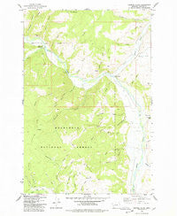
~ Cornish Gulch MT topo map, 1:24000 scale, 7.5 X 7.5 Minute, Historical, 1975, updated 1978
Cornish Gulch, Montana, USGS topographic map dated 1975.
Includes geographic coordinates (latitude and longitude). This topographic map is suitable for hiking, camping, and exploring, or framing it as a wall map.
Printed on-demand using high resolution imagery, on heavy weight and acid free paper, or alternatively on a variety of synthetic materials.
Topos available on paper, Waterproof, Poly, or Tyvek. Usually shipping rolled, unless combined with other folded maps in one order.
- Product Number: USGS-5392650
- Free digital map download (high-resolution, GeoPDF): Cornish Gulch, Montana (file size: 11 MB)
- Map Size: please refer to the dimensions of the GeoPDF map above
- Weight (paper map): ca. 55 grams
- Map Type: POD USGS Topographic Map
- Map Series: HTMC
- Map Verison: Historical
- Cell ID: 72327
- Scan ID: 263155
- Imprint Year: 1978
- Woodland Tint: Yes
- Visual Version Number: 2
- Aerial Photo Year: 1972
- Field Check Year: 1975
- Datum: NAD27
- Map Projection: Lambert Conformal Conic
- Map published by United States Geological Survey
- Map Language: English
- Scanner Resolution: 600 dpi
- Map Cell Name: Cornish Gulch
- Grid size: 7.5 X 7.5 Minute
- Date on map: 1975
- Map Scale: 1:24000
- Geographical region: Montana, United States
Neighboring Maps:
All neighboring USGS topo maps are available for sale online at a variety of scales.
Spatial coverage:
Topo map Cornish Gulch, Montana, covers the geographical area associated the following places:
- Silver King Mine - Ethridge Gulch - Basin Gulch Placer Mine - Montgomery Gulch - Antelope Creek - SW NE Section 5 Mine - Upper Willow Creek - Coal Gulch - NW NE Section 20 Mine - Ram Mountain - Jimmy Lee Gulch - Kyle G. Bohrnsen Pfc US Army Memorial Bridge - Browns Gulch - Ginger Gulch - North Fork Montgomery Gulch - Flat Gulch - Little Moffat Gulch - Aurora Gulch - Bi-Metalic Gulch - Cornish Gulch - Apache Gulch - Sluice Gulch - Eureka Gulch - NW SW Section 25 Mine - Basin Gulch - Anaconda Gulch - Wright Rock - Spring Creek - Scotchman Gulch - Hoodoo Gulch - Rau Gulch - Placer Post Office (historical) - SE NE Section 26 Mine - South Fork Montgomery Gulch - Quartz Gulch - Mill Gulch - Windlass Gulch - Blue Bell Mine - West Fork Buttes - Stony Creek Campground - Silver King Mine - Puller Gulch - Stony Creek - Papoose Gulch - Short Gulch - WB Development Placer Mine - The Wedge - Bobcat Field Airport
- Map Area ID: AREA46.37546.25-113.625-113.5
- Northwest corner Lat/Long code: USGSNW46.375-113.625
- Northeast corner Lat/Long code: USGSNE46.375-113.5
- Southwest corner Lat/Long code: USGSSW46.25-113.625
- Southeast corner Lat/Long code: USGSSE46.25-113.5
- Northern map edge Latitude: 46.375
- Southern map edge Latitude: 46.25
- Western map edge Longitude: -113.625
- Eastern map edge Longitude: -113.5


