
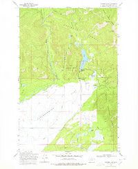
~ Coopers Lake MT topo map, 1:24000 scale, 7.5 X 7.5 Minute, Historical, 1968, updated 1978
Coopers Lake, Montana, USGS topographic map dated 1968.
Includes geographic coordinates (latitude and longitude). This topographic map is suitable for hiking, camping, and exploring, or framing it as a wall map.
Printed on-demand using high resolution imagery, on heavy weight and acid free paper, or alternatively on a variety of synthetic materials.
Topos available on paper, Waterproof, Poly, or Tyvek. Usually shipping rolled, unless combined with other folded maps in one order.
- Product Number: USGS-5392630
- Free digital map download (high-resolution, GeoPDF): Coopers Lake, Montana (file size: 12 MB)
- Map Size: please refer to the dimensions of the GeoPDF map above
- Weight (paper map): ca. 55 grams
- Map Type: POD USGS Topographic Map
- Map Series: HTMC
- Map Verison: Historical
- Cell ID: 10007
- Scan ID: 263143
- Imprint Year: 1978
- Woodland Tint: Yes
- Aerial Photo Year: 1958
- Field Check Year: 1968
- Datum: NAD27
- Map Projection: Polyconic
- Map published by United States Geological Survey
- Map Language: English
- Scanner Resolution: 600 dpi
- Map Cell Name: Coopers Lake
- Grid size: 7.5 X 7.5 Minute
- Date on map: 1968
- Map Scale: 1:24000
- Geographical region: Montana, United States
Neighboring Maps:
All neighboring USGS topo maps are available for sale online at a variety of scales.
Spatial coverage:
Topo map Coopers Lake, Montana, covers the geographical area associated the following places:
- Bull Creek - Spieker Ditch - Spawn Lake - Echo Pass - Jorgenson Ditch - Tupper Lake - Echo Mountain - 15N11W28DBBC01 Well - Old Lund Ditch - Deer Park - Salmon Creek - McDermott Creek - Kleinschmidt Flat - 15N11W02CBBD01 Well - Callahan Creek - 15N11W02BCBA01 Well - Lake Creek - Dry Creek - Copenhaver Ranch - Coopers Lake - Mineral Creek Trail - Bear Creek - White Tail Ranch - Madison Meadow - Bear Lake - Salmon Creek School (historical) - Big Nelson Campground - Day Creek Livestock Trail Head
- Map Area ID: AREA47.12547-113-112.875
- Northwest corner Lat/Long code: USGSNW47.125-113
- Northeast corner Lat/Long code: USGSNE47.125-112.875
- Southwest corner Lat/Long code: USGSSW47-113
- Southeast corner Lat/Long code: USGSSE47-112.875
- Northern map edge Latitude: 47.125
- Southern map edge Latitude: 47
- Western map edge Longitude: -113
- Eastern map edge Longitude: -112.875


