
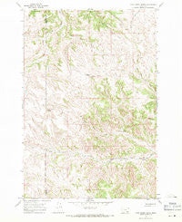
~ Cook Creek Butte MT topo map, 1:24000 scale, 7.5 X 7.5 Minute, Historical, 1967, updated 1971
Cook Creek Butte, Montana, USGS topographic map dated 1967.
Includes geographic coordinates (latitude and longitude). This topographic map is suitable for hiking, camping, and exploring, or framing it as a wall map.
Printed on-demand using high resolution imagery, on heavy weight and acid free paper, or alternatively on a variety of synthetic materials.
Topos available on paper, Waterproof, Poly, or Tyvek. Usually shipping rolled, unless combined with other folded maps in one order.
- Product Number: USGS-5392602
- Free digital map download (high-resolution, GeoPDF): Cook Creek Butte, Montana (file size: 14 MB)
- Map Size: please refer to the dimensions of the GeoPDF map above
- Weight (paper map): ca. 55 grams
- Map Type: POD USGS Topographic Map
- Map Series: HTMC
- Map Verison: Historical
- Cell ID: 69732
- Scan ID: 263126
- Imprint Year: 1971
- Woodland Tint: Yes
- Aerial Photo Year: 1966
- Field Check Year: 1967
- Datum: NAD27
- Map Projection: Polyconic
- Map published by United States Geological Survey
- Map Language: English
- Scanner Resolution: 600 dpi
- Map Cell Name: Cook Creek Butte
- Grid size: 7.5 X 7.5 Minute
- Date on map: 1967
- Map Scale: 1:24000
- Geographical region: Montana, United States
Neighboring Maps:
All neighboring USGS topo maps are available for sale online at a variety of scales.
Spatial coverage:
Topo map Cook Creek Butte, Montana, covers the geographical area associated the following places:
- 05S41E21BBCC01 Spring - 05S41E27BABD01 Spring - 05S41E22DCDC01 Spring - Cook Creek Butte - 05S41E18CBCD01 Spring - 05S41E20DDDB01 Well - 05S41E23BAAC01 Spring - 05S41E10ACBC01 Spring - Muddy School (historical) - 05S41E18BBC_01 Well - Buffalo Jump - 05S41E07CCDA01 Spring - 05S41E21DABB01 Spring - 05S41E21CAA_01 Well - 05S41E27ABBC01 Spring - 05S41E23DBAA01 Spring - 05S41E28ABC_01 Well - 05N41E28ABCC01 Spring - 05S41E26ABA_01 Well - 05S41E18BBCD01 Spring - 05S41E17ADCD01 Spring - 05S41E21CAAA01 Spring - Wild Hog Creek - 05S41E16CDDD01 Spring - 05S41E26ABAC01 Spring - Saint Johns Spring - 05S41E15CBDA01 Spring
- Map Area ID: AREA45.545.375-106.75-106.625
- Northwest corner Lat/Long code: USGSNW45.5-106.75
- Northeast corner Lat/Long code: USGSNE45.5-106.625
- Southwest corner Lat/Long code: USGSSW45.375-106.75
- Southeast corner Lat/Long code: USGSSE45.375-106.625
- Northern map edge Latitude: 45.5
- Southern map edge Latitude: 45.375
- Western map edge Longitude: -106.75
- Eastern map edge Longitude: -106.625


