
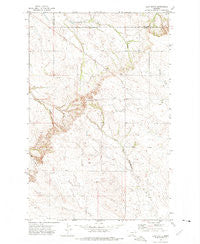
~ Clay Butte MT topo map, 1:24000 scale, 7.5 X 7.5 Minute, Historical, 1972, updated 1975
Clay Butte, Montana, USGS topographic map dated 1972.
Includes geographic coordinates (latitude and longitude). This topographic map is suitable for hiking, camping, and exploring, or framing it as a wall map.
Printed on-demand using high resolution imagery, on heavy weight and acid free paper, or alternatively on a variety of synthetic materials.
Topos available on paper, Waterproof, Poly, or Tyvek. Usually shipping rolled, unless combined with other folded maps in one order.
- Product Number: USGS-5392412
- Free digital map download (high-resolution, GeoPDF): Clay Butte, Montana (file size: 11 MB)
- Map Size: please refer to the dimensions of the GeoPDF map above
- Weight (paper map): ca. 55 grams
- Map Type: POD USGS Topographic Map
- Map Series: HTMC
- Map Verison: Historical
- Cell ID: 8987
- Scan ID: 263017
- Imprint Year: 1975
- Woodland Tint: Yes
- Aerial Photo Year: 1970
- Field Check Year: 1972
- Datum: NAD27
- Map Projection: Lambert Conformal Conic
- Map published by United States Geological Survey
- Map Language: English
- Scanner Resolution: 600 dpi
- Map Cell Name: Clay Butte
- Grid size: 7.5 X 7.5 Minute
- Date on map: 1972
- Map Scale: 1:24000
- Geographical region: Montana, United States
Neighboring Maps:
All neighboring USGS topo maps are available for sale online at a variety of scales.
Spatial coverage:
Topo map Clay Butte, Montana, covers the geographical area associated the following places:
- 20N54E06DCCA01 Well - 21N53E08ADCC01 Well - 21N53E10BBAD01 Well - 22N53E35CCCD01 Well - Bethlehem Church - Victory School (historical) - Clay Butte - 21N53E06CAAA01 Well - 21N53E21CAAB01 Well - 20N53E04DAAA01 Well - 21N53E08CCBB01 Well - Divide School (historical) - 21N53E29ADAD01 Well - Fairview School (historical) - Ziegler School (historical) - 21N53E22DAAB01 Well - 20N53E12BBAB01 Well
- Map Area ID: AREA47.62547.5-105-104.875
- Northwest corner Lat/Long code: USGSNW47.625-105
- Northeast corner Lat/Long code: USGSNE47.625-104.875
- Southwest corner Lat/Long code: USGSSW47.5-105
- Southeast corner Lat/Long code: USGSSE47.5-104.875
- Northern map edge Latitude: 47.625
- Southern map edge Latitude: 47.5
- Western map edge Longitude: -105
- Eastern map edge Longitude: -104.875


