
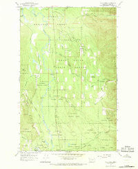
~ Cilly Creek MT topo map, 1:24000 scale, 7.5 X 7.5 Minute, Historical, 1965, updated 1968
Cilly Creek, Montana, USGS topographic map dated 1965.
Includes geographic coordinates (latitude and longitude). This topographic map is suitable for hiking, camping, and exploring, or framing it as a wall map.
Printed on-demand using high resolution imagery, on heavy weight and acid free paper, or alternatively on a variety of synthetic materials.
Topos available on paper, Waterproof, Poly, or Tyvek. Usually shipping rolled, unless combined with other folded maps in one order.
- Product Number: USGS-5392374
- Free digital map download (high-resolution, GeoPDF): Cilly Creek, Montana (file size: 11 MB)
- Map Size: please refer to the dimensions of the GeoPDF map above
- Weight (paper map): ca. 55 grams
- Map Type: POD USGS Topographic Map
- Map Series: HTMC
- Map Verison: Historical
- Cell ID: 8762
- Scan ID: 262993
- Imprint Year: 1968
- Woodland Tint: Yes
- Aerial Photo Year: 1964
- Field Check Year: 1965
- Datum: NAD27
- Map Projection: Polyconic
- Map published by United States Geological Survey
- Map Language: English
- Scanner Resolution: 600 dpi
- Map Cell Name: Cilly Creek
- Grid size: 7.5 X 7.5 Minute
- Date on map: 1965
- Map Scale: 1:24000
- Geographical region: Montana, United States
Neighboring Maps:
All neighboring USGS topo maps are available for sale online at a variety of scales.
Spatial coverage:
Topo map Cilly Creek, Montana, covers the geographical area associated the following places:
- State Meadows - Cilly Creek - Whitetail Creek - South Fork Lost Creek - Woodward Creek - Graves Meadows - Point Pleasant Campground - Porcupine Creek - Perry Creek - Swan River State Forest Headquarters - Napa Creek - In-pa-ah Creek - North Fork Lost Creek - South Woodward Creek - Lost Creek - Metcalf Lake - Soup Creek - Foothill Meadows - Soup Creek Campground - 24N17W07BCAA01 Well - Swan River Correctional Training Center
- Map Area ID: AREA47.87547.75-113.875-113.75
- Northwest corner Lat/Long code: USGSNW47.875-113.875
- Northeast corner Lat/Long code: USGSNE47.875-113.75
- Southwest corner Lat/Long code: USGSSW47.75-113.875
- Southeast corner Lat/Long code: USGSSE47.75-113.75
- Northern map edge Latitude: 47.875
- Southern map edge Latitude: 47.75
- Western map edge Longitude: -113.875
- Eastern map edge Longitude: -113.75


