
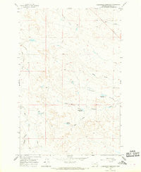
~ Christensen Reservoir MT topo map, 1:24000 scale, 7.5 X 7.5 Minute, Historical, 1965, updated 1969
Christensen Reservoir, Montana, USGS topographic map dated 1965.
Includes geographic coordinates (latitude and longitude). This topographic map is suitable for hiking, camping, and exploring, or framing it as a wall map.
Printed on-demand using high resolution imagery, on heavy weight and acid free paper, or alternatively on a variety of synthetic materials.
Topos available on paper, Waterproof, Poly, or Tyvek. Usually shipping rolled, unless combined with other folded maps in one order.
- Product Number: USGS-5392360
- Free digital map download (high-resolution, GeoPDF): Christensen Reservoir, Montana (file size: 9 MB)
- Map Size: please refer to the dimensions of the GeoPDF map above
- Weight (paper map): ca. 55 grams
- Map Type: POD USGS Topographic Map
- Map Series: HTMC
- Map Verison: Historical
- Cell ID: 8664
- Scan ID: 262985
- Imprint Year: 1969
- Aerial Photo Year: 1964
- Field Check Year: 1965
- Datum: NAD27
- Map Projection: Polyconic
- Map published by United States Geological Survey
- Map Language: English
- Scanner Resolution: 600 dpi
- Map Cell Name: Christenson Reservoir
- Grid size: 7.5 X 7.5 Minute
- Date on map: 1965
- Map Scale: 1:24000
- Geographical region: Montana, United States
Neighboring Maps:
All neighboring USGS topo maps are available for sale online at a variety of scales.
Spatial coverage:
Topo map Christensen Reservoir, Montana, covers the geographical area associated the following places:
- Bob Number 8 Dam - Bob Number 6 Dam - Jacques Coulee - Myers Coulee - Antone Reservoir - Christenson Reservoir - West Fork Lone Tree Creek - Harmony Dam - Bob Number 4 Dam - Section Four Reservoir - Section Four Dam - Smith Ranch 4 Dam - Disco Creek Dam - Christenson Dam - West Branch Coulee - Christenson Creek
- Map Area ID: AREA4746.875-106.625-106.5
- Northwest corner Lat/Long code: USGSNW47-106.625
- Northeast corner Lat/Long code: USGSNE47-106.5
- Southwest corner Lat/Long code: USGSSW46.875-106.625
- Southeast corner Lat/Long code: USGSSE46.875-106.5
- Northern map edge Latitude: 47
- Southern map edge Latitude: 46.875
- Western map edge Longitude: -106.625
- Eastern map edge Longitude: -106.5


