
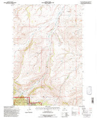
~ Cayuse Basin MT topo map, 1:24000 scale, 7.5 X 7.5 Minute, Historical, 1995, updated 1997
Cayuse Basin, Montana, USGS topographic map dated 1995.
Includes geographic coordinates (latitude and longitude). This topographic map is suitable for hiking, camping, and exploring, or framing it as a wall map.
Printed on-demand using high resolution imagery, on heavy weight and acid free paper, or alternatively on a variety of synthetic materials.
Topos available on paper, Waterproof, Poly, or Tyvek. Usually shipping rolled, unless combined with other folded maps in one order.
- Product Number: USGS-5392242
- Free digital map download (high-resolution, GeoPDF): Cayuse Basin, Montana (file size: 14 MB)
- Map Size: please refer to the dimensions of the GeoPDF map above
- Weight (paper map): ca. 55 grams
- Map Type: POD USGS Topographic Map
- Map Series: HTMC
- Map Verison: Historical
- Cell ID: 7748
- Scan ID: 262917
- Imprint Year: 1997
- Woodland Tint: Yes
- Aerial Photo Year: 1995
- Datum: NAD27
- Map Projection: Lambert Conformal Conic
- Map published by United States Geological Survey
- Map published by United States Forest Service
- Map Language: English
- Scanner Resolution: 600 dpi
- Map Cell Name: Cayuse Basin
- Grid size: 7.5 X 7.5 Minute
- Date on map: 1995
- Map Scale: 1:24000
- Geographical region: Montana, United States
Neighboring Maps:
All neighboring USGS topo maps are available for sale online at a variety of scales.
Spatial coverage:
Topo map Cayuse Basin, Montana, covers the geographical area associated the following places:
- 16N11E35BB__01 Spring - 16N11E27CB__01 Spring - 15N11E33CC__01 Spring - 15N11E11BA__01 Spring - 15N11E11AC__01 Spring - 16N11E33AA__01 Spring - 15N12E30CC__01 Spring - 14N11E03BB__01 Well - 15N11E18DD__02 Spring - Steamboat Butte - Dunsmore Coulee - 16N12E31BB__01 Spring - Nickerson Coulee - 16N11E32BC__01 Spring - 15N11E23BD__01 Spring - 15N11E03DB__02 Spring - 14N11E02CB__02 Spring - 16N12E31AC__02 Well - 15N11E34CD__01 Spring - 15N11E03DB__01 Well - 14N12E06BC__01 Spring - 15N11E27BB__01 Spring - 16N11E25BD__01 Well - 14N11E02CB__01 Spring - 14N11E04CA__01 Spring - 16N11E36BA__01 Well - 14N11E01AC__01 Spring - 15N11E03DA__01 Spring - 15N11E31DA__01 Spring - 15N11E04CC__01 Spring - 15N11E32CA__01 Well - 14N11E05DA__01 Spring - Steamerville (historical) - 16N11E26DC__01 Well - 15N11E28DC__01 Spring - 16N11E35BD__02 Well - 15N11E28CC__01 Spring - 15N11E11AC__02 Spring - 16N11E35BD__01 Well - 16N11E25DCBC01 Well - Skull Butte - 16N12E31____01 Well - 15N11E23CB__01 Spring - 15N11E04AA__01 Well - 15N11E32DC__01 Spring - 15N11E25CC__01 Spring - 14N11E05AD__02 Spring - 15N11E05DD__01 Spring - 15N11E04BC__01 Spring - 15N11E32BC__01 Spring - 15N11E18DD__01 Well - Judith Basin County - 15N11E14DD__01 Spring - Cayuse Basin - 15N11E14BD__01 Spring - 15N11E20DD__01 Spring - 15N11E08BD__01 Well - Running Wolf Creek - 16N11E35BC__01 Spring - 15N11E06DB__01 Spring - Vann Coulee - 16N11E25C___01 Well - 14N11E03AB__01 Spring - Coal Mine Coulee - 15N11E11AC__03 Spring - 16N11E32CD__01 Spring - 14N11E02BC__01 Spring - 15N12E06CC__01 Spring - 15N11E28DA__01 Spring - 15N11E05BB__01 Spring - 15N11E05BC__01 Spring - 16N11E35____01 Well - 14N11E04CB__01 Spring - 15N12E18CD__01 Well - 16N11E28AD__01 Spring - Dry Wolf Creek - 16N11E28BC__01 Spring - 15N11E21BA__01 Spring - 15N11E28CB__01 Spring - 16N12E31AC__01 Spring - 15N12E31BA__01 Spring - 16N11E27BC__01 Spring - 14N11E05AD__01 Spring
- Map Area ID: AREA47.12547-110.375-110.25
- Northwest corner Lat/Long code: USGSNW47.125-110.375
- Northeast corner Lat/Long code: USGSNE47.125-110.25
- Southwest corner Lat/Long code: USGSSW47-110.375
- Southeast corner Lat/Long code: USGSSE47-110.25
- Northern map edge Latitude: 47.125
- Southern map edge Latitude: 47
- Western map edge Longitude: -110.375
- Eastern map edge Longitude: -110.25


