
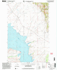
~ Canyon Ferry SE MT topo map, 1:24000 scale, 7.5 X 7.5 Minute, Historical, 2001, updated 2004
Canyon Ferry SE, Montana, USGS topographic map dated 2001.
Includes geographic coordinates (latitude and longitude). This topographic map is suitable for hiking, camping, and exploring, or framing it as a wall map.
Printed on-demand using high resolution imagery, on heavy weight and acid free paper, or alternatively on a variety of synthetic materials.
Topos available on paper, Waterproof, Poly, or Tyvek. Usually shipping rolled, unless combined with other folded maps in one order.
- Product Number: USGS-5392094
- Free digital map download (high-resolution, GeoPDF): Canyon Ferry SE, Montana (file size: 12 MB)
- Map Size: please refer to the dimensions of the GeoPDF map above
- Weight (paper map): ca. 55 grams
- Map Type: POD USGS Topographic Map
- Map Series: HTMC
- Map Verison: Historical
- Cell ID: 7137
- Scan ID: 262831
- Imprint Year: 2004
- Woodland Tint: Yes
- Aerial Photo Year: 1995
- Edit Year: 2001
- Datum: NAD27
- Map Projection: Lambert Conformal Conic
- Map published by United States Geological Survey
- Map published by United States Forest Service
- Map Language: English
- Scanner Resolution: 600 dpi
- Map Cell Name: Canyon Ferry SE
- Grid size: 7.5 X 7.5 Minute
- Date on map: 2001
- Map Scale: 1:24000
- Geographical region: Montana, United States
Neighboring Maps:
All neighboring USGS topo maps are available for sale online at a variety of scales.
Spatial coverage:
Topo map Canyon Ferry SE, Montana, covers the geographical area associated the following places:
- White Gulch - 09N02E19DA__02 Well - 10N01E28CABB01 Well - 09N02E06DD__01 Well - 09N01E26DC__03 Well - Number Sixteen Gulch - 09N01E22DC__01 Well - White Earth Campground - 09N02E20DB__01 Well - 09N01E28AAA_01 Well - Canyon Ferry Lake - 09N01E22DB__01 Well - Bilk Gulch - Grubb Gulch - 10N01E22CBD_01 Well - 09N02E29CB__01 Well - White Creek - Beaver Creek Cemetery (historical) - White Earth Recreation Area - 10N01E28AD__01 Well - 09N01E27AA__02 Well - 09N01E22DB__02 Well - 09N01E25DA__01 Well - 09N02E19DA__01 Well - Goose Bay - Goose Bay Marina Campground - Beaver Creek School (historical) - Spring Creek - 09N01E26DC__01 Well - 10N01E28ADCB01 Well - Beaver Creek - 09N01E27AA__01 Well
- Map Area ID: AREA46.62546.5-111.625-111.5
- Northwest corner Lat/Long code: USGSNW46.625-111.625
- Northeast corner Lat/Long code: USGSNE46.625-111.5
- Southwest corner Lat/Long code: USGSSW46.5-111.625
- Southeast corner Lat/Long code: USGSSE46.5-111.5
- Northern map edge Latitude: 46.625
- Southern map edge Latitude: 46.5
- Western map edge Longitude: -111.625
- Eastern map edge Longitude: -111.5


