
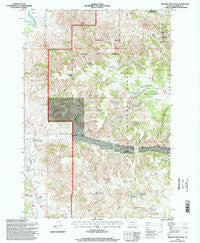
~ Browns Mountain MT topo map, 1:24000 scale, 7.5 X 7.5 Minute, Historical, 1995, updated 1998
Browns Mountain, Montana, USGS topographic map dated 1995.
Includes geographic coordinates (latitude and longitude). This topographic map is suitable for hiking, camping, and exploring, or framing it as a wall map.
Printed on-demand using high resolution imagery, on heavy weight and acid free paper, or alternatively on a variety of synthetic materials.
Topos available on paper, Waterproof, Poly, or Tyvek. Usually shipping rolled, unless combined with other folded maps in one order.
- Product Number: USGS-5391836
- Free digital map download (high-resolution, GeoPDF): Browns Mountain, Montana (file size: 18 MB)
- Map Size: please refer to the dimensions of the GeoPDF map above
- Weight (paper map): ca. 55 grams
- Map Type: POD USGS Topographic Map
- Map Series: HTMC
- Map Verison: Historical
- Cell ID: 5732
- Scan ID: 262692
- Imprint Year: 1998
- Woodland Tint: Yes
- Aerial Photo Year: 1991
- Datum: NAD27
- Map Projection: Lambert Conformal Conic
- Map published by United States Geological Survey
- Map published by United States Forest Service
- Map Language: English
- Scanner Resolution: 600 dpi
- Map Cell Name: Browns Mountain
- Grid size: 7.5 X 7.5 Minute
- Date on map: 1995
- Map Scale: 1:24000
- Geographical region: Montana, United States
Neighboring Maps:
All neighboring USGS topo maps are available for sale online at a variety of scales.
Spatial coverage:
Topo map Browns Mountain, Montana, covers the geographical area associated the following places:
- Timber Creek Spring Number One - Gilliland Ranch - 05S44E10ADCB01 Spring - 07S43E04DBCA01 Well - Ashland Division - Timber Creek Reservoir - Cottonwood Spring - Daniels Ranch - Peach Creek - Bones Ranch - Hackley Spring - Black Eagle Spring Number Two - Prune Spring - Black Eagle Spring Number One - 07S43E05ABDB01 Well - Timber Creek - 06S44E29BCBD01 Well - Wild Hog Coulee - Roberts Spring - Griffin Gulch - East Fork Hanging Woman Creek - Griffin Spring - Timber Creek Basin Spring - Poker Jim Research Natural Area - McGhee Gulch - Timber Creek Basin Reservoir - Rough Prong Spring - Tongue River Breaks Hiking and Riding Area - Browns Mountain - Poker Jim Reservoir Number Two - Roberts Gulch Reservoir - 05S45E34AACD01 Well - 07S43E05ACCA01 Well - Lee Creek - 06S44E30____01 Well - Roberts Gulch - Black Eagle Creek
- Map Area ID: AREA45.37545.25-106.5-106.375
- Northwest corner Lat/Long code: USGSNW45.375-106.5
- Northeast corner Lat/Long code: USGSNE45.375-106.375
- Southwest corner Lat/Long code: USGSSW45.25-106.5
- Southeast corner Lat/Long code: USGSSE45.25-106.375
- Northern map edge Latitude: 45.375
- Southern map edge Latitude: 45.25
- Western map edge Longitude: -106.5
- Eastern map edge Longitude: -106.375


