
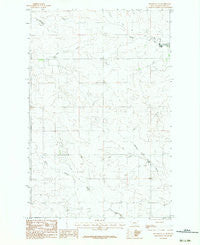
~ Brockway NE MT topo map, 1:24000 scale, 7.5 X 7.5 Minute, Historical, 1983, updated 1983
Brockway NE, Montana, USGS topographic map dated 1983.
Includes geographic coordinates (latitude and longitude). This topographic map is suitable for hiking, camping, and exploring, or framing it as a wall map.
Printed on-demand using high resolution imagery, on heavy weight and acid free paper, or alternatively on a variety of synthetic materials.
Topos available on paper, Waterproof, Poly, or Tyvek. Usually shipping rolled, unless combined with other folded maps in one order.
- Product Number: USGS-5391796
- Free digital map download (high-resolution, GeoPDF): Brockway NE, Montana (file size: 9 MB)
- Map Size: please refer to the dimensions of the GeoPDF map above
- Weight (paper map): ca. 55 grams
- Map Type: POD USGS Topographic Map
- Map Series: HTMC
- Map Verison: Historical
- Cell ID: 5566
- Scan ID: 262673
- Imprint Year: 1983
- Woodland Tint: Yes
- Aerial Photo Year: 1975
- Edit Year: 1983
- Field Check Year: 1977
- Datum: NAD27
- Map Projection: Lambert Conformal Conic
- Provisional map: Yes
- Map published by United States Geological Survey
- Map Language: English
- Scanner Resolution: 600 dpi
- Map Cell Name: Brockway NE
- Grid size: 7.5 X 7.5 Minute
- Date on map: 1983
- Map Scale: 1:24000
- Geographical region: Montana, United States
Neighboring Maps:
All neighboring USGS topo maps are available for sale online at a variety of scales.
Spatial coverage:
Topo map Brockway NE, Montana, covers the geographical area associated the following places:
- 19N46E10CDCC01 Well - Wheatley Farms Number 1 Dam - 19N46E23BBDB01 Well - 20N46E34BCAA01 Well - 20N47E31DDBC01 Well - Pawlowski Reservoir Dam - 20N46E36BBDA01 Well - 20N46E13BBCC01 Well - 19N47E08DCDC01 Well - 20N46E28BAAD01 Well - 20N46E24CCDD01 Well - L Pawlowske Number 1 Dam - 20N46E27BCAB01 Well - 19N46E17DAAC01 Well - 19N47E20CDAC01 Well - Moos Number 1 Dam - 19N46E17DAAD01 Well - 19N47E17BCCB01 Well - 20N46E24CDCC01 Well - 19N46E21ABBB01 Well - 20N47E30DBBA01 Well - 20N47E30ACCC03 Well - 19N46E28ABBA01 Well - Circle Division - 20N46E33BBAC01 Well - 20N47E29ABAA01 Well - 19N47E08CCDC01 Well - 20N47E29ABAA02 Well - 20N47E18ABAD01 Well - 20N46E24DBCB01 Well - 20N46E28ABBC01 Well - 19N46E10CDCA01 Well - Wheatley Farms Number 2 Dam - 20N47E30ACCC02 Well - 20N46E35DCAC01 Well - North Fork Horse Creek - 20N47E30ACCC01 Well - South Fork Horse Creek - Horse Creek Post Office (historical) - 19N46E15CBCA01 Well - 20N47E29BBDB01 Well - Mathilda Number 1 Dam
- Map Area ID: AREA47.547.375-105.875-105.75
- Northwest corner Lat/Long code: USGSNW47.5-105.875
- Northeast corner Lat/Long code: USGSNE47.5-105.75
- Southwest corner Lat/Long code: USGSSW47.375-105.875
- Southeast corner Lat/Long code: USGSSE47.375-105.75
- Northern map edge Latitude: 47.5
- Southern map edge Latitude: 47.375
- Western map edge Longitude: -105.875
- Eastern map edge Longitude: -105.75


