
~ Bluewater MT topo map, 1:24000 scale, 7.5 X 7.5 Minute, Historical, 1967, updated 1971
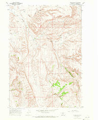
Bluewater, Montana, USGS topographic map dated 1967.
Includes geographic coordinates (latitude and longitude). This topographic map is suitable for hiking, camping, and exploring, or framing it as a wall map.
Printed on-demand using high resolution imagery, on heavy weight and acid free paper, or alternatively on a variety of synthetic materials.
Topos available on paper, Waterproof, Poly, or Tyvek. Usually shipping rolled, unless combined with other folded maps in one order.
- Product Number: USGS-5391628
- Free digital map download (high-resolution, GeoPDF): Bluewater, Montana (file size: 13 MB)
- Map Size: please refer to the dimensions of the GeoPDF map above
- Weight (paper map): ca. 55 grams
- Map Type: POD USGS Topographic Map
- Map Series: HTMC
- Map Verison: Historical
- Cell ID: 4582
- Scan ID: 262584
- Imprint Year: 1971
- Woodland Tint: Yes
- Aerial Photo Year: 1966
- Field Check Year: 1967
- Datum: NAD27
- Map Projection: Polyconic
- Map published by United States Geological Survey
- Map Language: English
- Scanner Resolution: 600 dpi
- Map Cell Name: Bluewater
- Grid size: 7.5 X 7.5 Minute
- Date on map: 1967
- Map Scale: 1:24000
- Geographical region: Montana, United States
Neighboring Maps:
All neighboring USGS topo maps are available for sale online at a variety of scales.
Spatial coverage:
Topo map Bluewater, Montana, covers the geographical area associated the following places:
- 06S24E04DDBA01 Well - Bachelder Canyon - Bluewater Spring - Teeples Ranch Cemetery - Frosty Jack Creek - Orchard Ditch - Prewett Spring - 06S24E03CC__01 Spring - Bluewater School (historical) - 06S24E09BD__01 Spring - 06S24E16AB__01 Spring - 06S24E09AD__02 Spring - 06S24E04DD__02 Spring - 06S24E22CA__01 Spring - Cherry Springs - 06S24E15DB__01 Spring - 06S24E04DD__01 Well - 06S24E09BD__02 Spring - 06S24E27AB__01 Spring - Ruckavina Well Number One - 06S24E09CD__01 Spring - North Fork Bluewater Creek - South Fork Bluewater Creek - O'Connor Ditch - Big Bluewater Spring - 06S24E15BD__01 Spring - Bluewater Fish Hatchery - 06S24E09AA__02 Spring - 06S24E09DC__01 Spring - Ruckavina Well Number Two - 06S24E09AD__01 Spring - 06S24E15CA__01 Spring - Ruckavina Well Number Three - 06S24E16BD__01 Spring - 06S24E09AC__02 Spring - 06S24E09BCAA01 Spring - 06S24E09AA__01 Spring - 06S24E09AC__03 Spring - Bluewater Fish Hatchery Fishing Access Site - 06S24E10DCDD01 Well - Bachelder Spring - 06S24E09AC__01 Spring
- Map Area ID: AREA45.37545.25-108.875-108.75
- Northwest corner Lat/Long code: USGSNW45.375-108.875
- Northeast corner Lat/Long code: USGSNE45.375-108.75
- Southwest corner Lat/Long code: USGSSW45.25-108.875
- Southeast corner Lat/Long code: USGSSE45.25-108.75
- Northern map edge Latitude: 45.375
- Southern map edge Latitude: 45.25
- Western map edge Longitude: -108.875
- Eastern map edge Longitude: -108.75


