
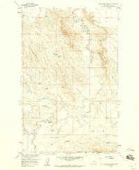
~ Blanchard Ranch MT topo map, 1:24000 scale, 7.5 X 7.5 Minute, Historical, 1958, updated 1960
Blanchard Ranch, Montana, USGS topographic map dated 1958.
Includes geographic coordinates (latitude and longitude). This topographic map is suitable for hiking, camping, and exploring, or framing it as a wall map.
Printed on-demand using high resolution imagery, on heavy weight and acid free paper, or alternatively on a variety of synthetic materials.
Topos available on paper, Waterproof, Poly, or Tyvek. Usually shipping rolled, unless combined with other folded maps in one order.
- Product Number: USGS-5391562
- Free digital map download (high-resolution, GeoPDF): Blanchard Ranch, Montana (file size: 12 MB)
- Map Size: please refer to the dimensions of the GeoPDF map above
- Weight (paper map): ca. 55 grams
- Map Type: POD USGS Topographic Map
- Map Series: HTMC
- Map Verison: Historical
- Cell ID: 4341
- Scan ID: 262550
- Imprint Year: 1960
- Aerial Photo Year: 1956
- Field Check Year: 1958
- Datum: NAD27
- Map Projection: Polyconic
- Map published by United States Geological Survey
- Map Language: English
- Scanner Resolution: 600 dpi
- Map Cell Name: Blanchard Ranch
- Grid size: 7.5 X 7.5 Minute
- Date on map: 1958
- Map Scale: 1:24000
- Geographical region: Montana, United States
Neighboring Maps:
All neighboring USGS topo maps are available for sale online at a variety of scales.
Spatial coverage:
Topo map Blanchard Ranch, Montana, covers the geographical area associated the following places:
- Whodiky Dam - Jack Rabbit Reservoir - Blanchard Reservoir - Archambeault Retention Dam - Willow Bend School (historical) - Beaver Creek - 26N39E01CCBC01 Well - Blanchard Ranch - Newton Reservoir - Mud Run Reservoir - Blanchard Detention Reservoir Dam - VR-105 Reservoir - Road Reservoir Dam - Aitken Reservoir - Baldy Pit - Mud Creek - Archambeault Flats - Archambeault Ranch - Archambeault Retention Reservoir - Sage Hen Creek - Coyote Creek - Road Reservoir - 28N39E35ADBA01 Well
- Map Area ID: AREA48.12548-106.75-106.625
- Northwest corner Lat/Long code: USGSNW48.125-106.75
- Northeast corner Lat/Long code: USGSNE48.125-106.625
- Southwest corner Lat/Long code: USGSSW48-106.75
- Southeast corner Lat/Long code: USGSSE48-106.625
- Northern map edge Latitude: 48.125
- Southern map edge Latitude: 48
- Western map edge Longitude: -106.75
- Eastern map edge Longitude: -106.625


