
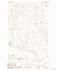
~ Bjornberg Bridge MT topo map, 1:24000 scale, 7.5 X 7.5 Minute, Historical, 1984, updated 1984
Bjornberg Bridge, Montana, USGS topographic map dated 1984.
Includes geographic coordinates (latitude and longitude). This topographic map is suitable for hiking, camping, and exploring, or framing it as a wall map.
Printed on-demand using high resolution imagery, on heavy weight and acid free paper, or alternatively on a variety of synthetic materials.
Topos available on paper, Waterproof, Poly, or Tyvek. Usually shipping rolled, unless combined with other folded maps in one order.
- Product Number: USGS-5391492
- Free digital map download (high-resolution, GeoPDF): Bjornberg Bridge, Montana (file size: 10 MB)
- Map Size: please refer to the dimensions of the GeoPDF map above
- Weight (paper map): ca. 55 grams
- Map Type: POD USGS Topographic Map
- Map Series: HTMC
- Map Verison: Historical
- Cell ID: 69368
- Scan ID: 262513
- Imprint Year: 1984
- Woodland Tint: Yes
- Aerial Photo Year: 1974
- Edit Year: 1984
- Field Check Year: 1976
- Datum: NAD27
- Map Projection: Lambert Conformal Conic
- Provisional map: Yes
- Map published by United States Geological Survey
- Map Language: English
- Scanner Resolution: 600 dpi
- Map Cell Name: Bjornberg Bridge
- Grid size: 7.5 X 7.5 Minute
- Date on map: 1984
- Map Scale: 1:24000
- Geographical region: Montana, United States
Neighboring Maps:
All neighboring USGS topo maps are available for sale online at a variety of scales.
Spatial coverage:
Topo map Bjornberg Bridge, Montana, covers the geographical area associated the following places:
- Anderson Coulee - Farmer Spring - North Bench School (historical) - Farmer Coulee - West Fork Cash Creek - Snieder Spring - Swanson Coulee - Stuff School (historical) - McChesney Springs - Smoke School (historical) - Frenchman Irrigation Company Canal - Taylor Spring - Burnt Shed Coulee - Smith Coulee - Snieder Coulee - Nelson's Ranch - East Fork Cash Creek - West Cache Creek School (historical) - 33N35E17BCCC01 Well - Snieder's Ranch - Bjornberg Bridge - Stevens Coulee - Bell Coulee - Middle Fork Cash Creek - Bjornberg Bridge Fishing Access Site - McChesney Reservoir - North Spring - Chesley Slough - Bucher Coulee - Frenchman Creek School (historical)
- Map Area ID: AREA48.62548.5-107.25-107.125
- Northwest corner Lat/Long code: USGSNW48.625-107.25
- Northeast corner Lat/Long code: USGSNE48.625-107.125
- Southwest corner Lat/Long code: USGSSW48.5-107.25
- Southeast corner Lat/Long code: USGSSE48.5-107.125
- Northern map edge Latitude: 48.625
- Southern map edge Latitude: 48.5
- Western map edge Longitude: -107.25
- Eastern map edge Longitude: -107.125


