
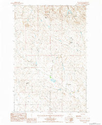
~ Biscuit Butte MT topo map, 1:24000 scale, 7.5 X 7.5 Minute, Historical, 1983, updated 1984
Biscuit Butte, Montana, USGS topographic map dated 1983.
Includes geographic coordinates (latitude and longitude). This topographic map is suitable for hiking, camping, and exploring, or framing it as a wall map.
Printed on-demand using high resolution imagery, on heavy weight and acid free paper, or alternatively on a variety of synthetic materials.
Topos available on paper, Waterproof, Poly, or Tyvek. Usually shipping rolled, unless combined with other folded maps in one order.
- Product Number: USGS-5391480
- Free digital map download (high-resolution, GeoPDF): Biscuit Butte, Montana (file size: 12 MB)
- Map Size: please refer to the dimensions of the GeoPDF map above
- Weight (paper map): ca. 55 grams
- Map Type: POD USGS Topographic Map
- Map Series: HTMC
- Map Verison: Historical
- Cell ID: 4016
- Scan ID: 262507
- Imprint Year: 1984
- Woodland Tint: Yes
- Aerial Photo Year: 1979
- Edit Year: 1983
- Field Check Year: 1981
- Datum: NAD27
- Map Projection: Lambert Conformal Conic
- Provisional map: Yes
- Map published by United States Geological Survey
- Map Language: English
- Scanner Resolution: 600 dpi
- Map Cell Name: Biscuit Butte
- Grid size: 7.5 X 7.5 Minute
- Date on map: 1983
- Map Scale: 1:24000
- Geographical region: Montana, United States
Neighboring Maps:
All neighboring USGS topo maps are available for sale online at a variety of scales.
Spatial coverage:
Topo map Biscuit Butte, Montana, covers the geographical area associated the following places:
- Castle Butte - Lehner Dam - Sage Hen Buttes - McKrone Spring - McKrone Reservoir - Murion B Number 2 Dam - 20N36E27CCA_01 Well - Finger Butte Post Office (historical) - 19N36E03AA__01 Well - Murnion Dam - Haystack Butte - Biscuit Butte - Camel Coulee - B Murion Number 3 Dam - Fannon Number 2 Dam - Sage Hen Coulee - Biscuit Butte Spring - Fannon Number 1 Dam - North Garfield Division - Engdahl Number 3 Dam - Lindbergh Spring
- Map Area ID: AREA47.547.375-107.125-107
- Northwest corner Lat/Long code: USGSNW47.5-107.125
- Northeast corner Lat/Long code: USGSNE47.5-107
- Southwest corner Lat/Long code: USGSSW47.375-107.125
- Southeast corner Lat/Long code: USGSSE47.375-107
- Northern map edge Latitude: 47.5
- Southern map edge Latitude: 47.375
- Western map edge Longitude: -107.125
- Eastern map edge Longitude: -107


