
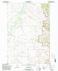
~ Belltower MT topo map, 1:24000 scale, 7.5 X 7.5 Minute, Historical, 1993, updated 1996
Belltower, Montana, USGS topographic map dated 1993.
Includes geographic coordinates (latitude and longitude). This topographic map is suitable for hiking, camping, and exploring, or framing it as a wall map.
Printed on-demand using high resolution imagery, on heavy weight and acid free paper, or alternatively on a variety of synthetic materials.
Topos available on paper, Waterproof, Poly, or Tyvek. Usually shipping rolled, unless combined with other folded maps in one order.
- Product Number: USGS-5391240
- Free digital map download (high-resolution, GeoPDF): Belltower, Montana (file size: 10 MB)
- Map Size: please refer to the dimensions of the GeoPDF map above
- Weight (paper map): ca. 55 grams
- Map Type: POD USGS Topographic Map
- Map Series: HTMC
- Map Verison: Historical
- Cell ID: 3216
- Scan ID: 262383
- Imprint Year: 1996
- Woodland Tint: Yes
- Aerial Photo Year: 1991
- Field Check Year: 1993
- Datum: NAD27
- Map Projection: Lambert Conformal Conic
- Map published by United States Forest Service
- Map Language: English
- Scanner Resolution: 600 dpi
- Map Cell Name: Belltower
- Grid size: 7.5 X 7.5 Minute
- Date on map: 1993
- Map Scale: 1:24000
- Geographical region: Montana, United States
Neighboring Maps:
All neighboring USGS topo maps are available for sale online at a variety of scales.
Spatial coverage:
Topo map Belltower, Montana, covers the geographical area associated the following places:
- Bell Tower Hall - Devils Canyon - Burditt Reservoir - Devils Canyon Creek - Sykes Post Office (historical) - Horse Killer Reservoir - Sykes Corner - V-Bar-S Reservoir - Belltower School (historical) - Elgin School (historical) - Belltower Seventh Day Adventist Church - Speelmon Creek - Short Draw - 02S60E11CBAD01 Well - 02S60E28A___01 Well - Devils Canyon Reservoir - E-B Reservoir - Ekalaka Mini-Mutes Radar Site - Maverick Gulch - Maverick Reservoir - Lampkin Gulch Reservoir - Big Ramme Creek
- Map Area ID: AREA45.7545.625-104.375-104.25
- Northwest corner Lat/Long code: USGSNW45.75-104.375
- Northeast corner Lat/Long code: USGSNE45.75-104.25
- Southwest corner Lat/Long code: USGSSW45.625-104.375
- Southeast corner Lat/Long code: USGSSE45.625-104.25
- Northern map edge Latitude: 45.75
- Southern map edge Latitude: 45.625
- Western map edge Longitude: -104.375
- Eastern map edge Longitude: -104.25


