
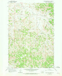
~ Beaver Creek School MT topo map, 1:24000 scale, 7.5 X 7.5 Minute, Historical, 1966, updated 1969
Beaver Creek School, Montana, USGS topographic map dated 1966.
Includes geographic coordinates (latitude and longitude). This topographic map is suitable for hiking, camping, and exploring, or framing it as a wall map.
Printed on-demand using high resolution imagery, on heavy weight and acid free paper, or alternatively on a variety of synthetic materials.
Topos available on paper, Waterproof, Poly, or Tyvek. Usually shipping rolled, unless combined with other folded maps in one order.
- Product Number: USGS-5391150
- Free digital map download (high-resolution, GeoPDF): Beaver Creek School, Montana (file size: 14 MB)
- Map Size: please refer to the dimensions of the GeoPDF map above
- Weight (paper map): ca. 55 grams
- Map Type: POD USGS Topographic Map
- Map Series: HTMC
- Map Verison: Historical
- Cell ID: 2935
- Scan ID: 262340
- Imprint Year: 1969
- Woodland Tint: Yes
- Aerial Photo Year: 1962
- Field Check Year: 1966
- Datum: NAD27
- Map Projection: Polyconic
- Map published by United States Geological Survey
- Map Language: English
- Scanner Resolution: 600 dpi
- Map Cell Name: Beaver Creek School
- Grid size: 7.5 X 7.5 Minute
- Date on map: 1966
- Map Scale: 1:24000
- Geographical region: Montana, United States
Neighboring Maps:
All neighboring USGS topo maps are available for sale online at a variety of scales.
Spatial coverage:
Topo map Beaver Creek School, Montana, covers the geographical area associated the following places:
- West Fork Ash Creek - 02S46E15BDBC01 Well - Sawmill Reservoir - Funnel Draw - Beaver Creek Spring - 01S46E33DADB01 Well - Main Ash Reservoir - Cabin Creek Well - Sheep Creek - 02S46E10DBDA01 Spring - Deer Creek Reservoir Number Two - Maxwell Well - 02S46E02DBBB01 Well - 01S46E28BAAB01 Well - Cabin Creek Spring - Beaver Creek School (historical) - 02S46E17BACA01 Spring - Deer Creek - Maxwell Spring - Schiller Creek - 02S46E03CA__01 Well - 02S46E08CCCD01 Spring - Deer Creek Reservoir Number Three - 01S46E28ADDD01 Well - North Fork Beaver Creek - Upper Deer Creek Well - 01S46E30DBDC01 Well - East Fork Beaver Creek - Deer Creek Spring - 02S46E09ACBD01 Well - 01S45E36DABC01 Well - 02S46E22DBCA01 Spring - 01S46E21DCBC01 Well - Schiller Reservoir - Main Ash Spring - 01S45E25DDCA01 Well - Lower Deer Creek Well - 01S46E30ADCA01 Well - Cabin Creek - Ash Creek - Straight Creek - 01S46E27BCBC01 Well - 01S46E29BBDA01 Well - Deer Creek Reservoir Number One - Maxwell Creek - North Sartin Draw - 02S46E05AACB01 Well - Sartin Draw - Darling Draw Spring - 01S46E30ADCA02 Well - Sartin Draw Reservoir - 01S46E34CBDA01 Well
- Map Area ID: AREA45.7545.625-106.125-106
- Northwest corner Lat/Long code: USGSNW45.75-106.125
- Northeast corner Lat/Long code: USGSNE45.75-106
- Southwest corner Lat/Long code: USGSSW45.625-106.125
- Southeast corner Lat/Long code: USGSSE45.625-106
- Northern map edge Latitude: 45.75
- Southern map edge Latitude: 45.625
- Western map edge Longitude: -106.125
- Eastern map edge Longitude: -106


