
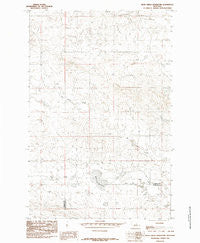
~ Bear Creek Reservoir MT topo map, 1:24000 scale, 7.5 X 7.5 Minute, Historical, 1985, updated 1985
Bear Creek Reservoir, Montana, USGS topographic map dated 1985.
Includes geographic coordinates (latitude and longitude). This topographic map is suitable for hiking, camping, and exploring, or framing it as a wall map.
Printed on-demand using high resolution imagery, on heavy weight and acid free paper, or alternatively on a variety of synthetic materials.
Topos available on paper, Waterproof, Poly, or Tyvek. Usually shipping rolled, unless combined with other folded maps in one order.
- Product Number: USGS-5391100
- Free digital map download (high-resolution, GeoPDF): Bear Creek Reservoir, Montana (file size: 10 MB)
- Map Size: please refer to the dimensions of the GeoPDF map above
- Weight (paper map): ca. 55 grams
- Map Type: POD USGS Topographic Map
- Map Series: HTMC
- Map Verison: Historical
- Cell ID: 69285
- Scan ID: 262313
- Imprint Year: 1985
- Aerial Photo Year: 1978
- Edit Year: 1985
- Field Check Year: 1979
- Datum: NAD27
- Map Projection: Lambert Conformal Conic
- Map published by United States Geological Survey
- Map Language: English
- Scanner Resolution: 600 dpi
- Map Cell Name: Bear Creek Reservoir
- Grid size: 7.5 X 7.5 Minute
- Date on map: 1985
- Map Scale: 1:24000
- Geographical region: Montana, United States
Neighboring Maps:
All neighboring USGS topo maps are available for sale online at a variety of scales.
Spatial coverage:
Topo map Bear Creek Reservoir, Montana, covers the geographical area associated the following places:
- Cooper-Adams Number 4 Dam - Cooper-Adams Number 6 Dam - Peters Number 2 Dam - Cooper Adams Number 1 Dam - Cooper-Adams Number 5 Dam - Styer Number 2 Dam - 18N24E14BAB_01 Well - Christensen Post Office (historical) - Valley View School (historical) - Dory Post Office (historical) - 18N24E29BBD_01 Well - Havre Reservoir Dam - Bear Creek Reservoir - Peters Dam - Fink Number 2 Dam - Waverly Presbyterian Church (historical) - 18N24E14BB__01 Well - 18N25E07CADB01 Well - Box Elder School (historical) - Adams Number 2 Dam - 18N23E11DD__01 Well
- Map Area ID: AREA47.37547.25-108.75-108.625
- Northwest corner Lat/Long code: USGSNW47.375-108.75
- Northeast corner Lat/Long code: USGSNE47.375-108.625
- Southwest corner Lat/Long code: USGSSW47.25-108.75
- Southeast corner Lat/Long code: USGSSE47.25-108.625
- Northern map edge Latitude: 47.375
- Southern map edge Latitude: 47.25
- Western map edge Longitude: -108.75
- Eastern map edge Longitude: -108.625


