
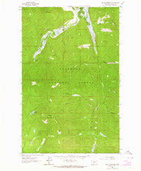
~ Ashley Mountain MT topo map, 1:24000 scale, 7.5 X 7.5 Minute, Historical, 1962, updated 1964
Ashley Mountain, Montana, USGS topographic map dated 1962.
Includes geographic coordinates (latitude and longitude). This topographic map is suitable for hiking, camping, and exploring, or framing it as a wall map.
Printed on-demand using high resolution imagery, on heavy weight and acid free paper, or alternatively on a variety of synthetic materials.
Topos available on paper, Waterproof, Poly, or Tyvek. Usually shipping rolled, unless combined with other folded maps in one order.
- Product Number: USGS-5390862
- Free digital map download (high-resolution, GeoPDF): Ashley Mountain, Montana (file size: 13 MB)
- Map Size: please refer to the dimensions of the GeoPDF map above
- Weight (paper map): ca. 55 grams
- Map Type: POD USGS Topographic Map
- Map Series: HTMC
- Map Verison: Historical
- Cell ID: 72263
- Scan ID: 262194
- Imprint Year: 1964
- Woodland Tint: Yes
- Aerial Photo Year: 1956
- Field Check Year: 1962
- Datum: NAD27
- Map Projection: Polyconic
- Map published by United States Geological Survey
- Map Language: English
- Scanner Resolution: 600 dpi
- Map Cell Name: Ashley Mountain
- Grid size: 7.5 X 7.5 Minute
- Date on map: 1962
- Map Scale: 1:24000
- Geographical region: Montana, United States
Neighboring Maps:
All neighboring USGS topo maps are available for sale online at a variety of scales.
Spatial coverage:
Topo map Ashley Mountain, Montana, covers the geographical area associated the following places:
- Sheppard Creek - Taylor Creek - Copper King Mine - Lupine Lake Trail - Ashley Divide Trail - Star Meadow Ranch - Salish Mountains - Lupine Lake - Sullivan Creek - Logan Creek Trail - Kalispell Northwest Division - Bill Creek - Meadow Creek - Ashley Divide - Cyclone Creek - Ashley Mountain - Ashley Mountain Lookout Tower - Griffin Creek - Griffin Creek Trail - Oettiker Creek - Star Meadow - Meadow Creek Trail
- Map Area ID: AREA48.37548.25-114.75-114.625
- Northwest corner Lat/Long code: USGSNW48.375-114.75
- Northeast corner Lat/Long code: USGSNE48.375-114.625
- Southwest corner Lat/Long code: USGSSW48.25-114.75
- Southeast corner Lat/Long code: USGSSE48.25-114.625
- Northern map edge Latitude: 48.375
- Southern map edge Latitude: 48.25
- Western map edge Longitude: -114.75
- Eastern map edge Longitude: -114.625


