
~ Wilmington North DE topo map, 1:24000 scale, 7.5 X 7.5 Minute, Historical, 1993, updated 1993
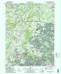
Wilmington North, Delaware, USGS topographic map dated 1993.
Includes geographic coordinates (latitude and longitude). This topographic map is suitable for hiking, camping, and exploring, or framing it as a wall map.
Printed on-demand using high resolution imagery, on heavy weight and acid free paper, or alternatively on a variety of synthetic materials.
Topos available on paper, Waterproof, Poly, or Tyvek. Usually shipping rolled, unless combined with other folded maps in one order.
- Product Number: USGS-5390244
- Free digital map download (high-resolution, GeoPDF): Wilmington North, Delaware (file size: 19 MB)
- Map Size: please refer to the dimensions of the GeoPDF map above
- Weight (paper map): ca. 55 grams
- Map Type: POD USGS Topographic Map
- Map Series: HTMC
- Map Verison: Historical
- Cell ID: 49297
- Scan ID: 255687
- Imprint Year: 1993
- Woodland Tint: Yes
- Visual Version Number: 2
- Aerial Photo Year: 1989
- Edit Year: 1993
- Field Check Year: 1991
- Datum: NAD83
- Map Projection: Universal Transverse Mercator
- Map published by United States Geological Survey
- Map Language: English
- Scanner Resolution: 600 dpi
- Map Cell Name: Wilmington North
- Grid size: 7.5 X 7.5 Minute
- Date on map: 1993
- Map Scale: 1:24000
- Geographical region: Delaware, United States
Neighboring Maps:
All neighboring USGS topo maps are available for sale online at a variety of scales.
Spatial coverage:
Topo map Wilmington North, Delaware, covers the geographical area associated the following places:
- Deerhurst - Cossart Creek - West Farm - Sharpley - Augustine Hills - Twin Turns Farm - Greenville Place - Kershaw Acres - Winterset Farms - Shipley Woods - Carrcroft Crest - Wexford Chapelcroft - Brandywine Perry Park - Brookcroft - West Haven - Holiday Hills - Johnsons Corner - Chadds Ford Knoll - Queonemysing (historical) - Delaware Heights - Green Meadow - Silver Springs - Brandywine Summit - Concord Hunt - Cossart - Rockland - Gumwood - Country Gates - Wickwood - Hampton - Ringfield - Concord - Normandy Manor - Chadds Ford Junction - Concord Manor - Weber Tract - Sedgley Farms - North Chase - Guyencourt - Forwood - Ebright - Chadds Ford - Pennington - Weldin Park - Concord Crossing - Wynleigh - Rockwood Woods - Galewood - Boulder Brook - Talleyville - Deerbrook I - Weldin Woods - Arborlea - Gordon Heights - Wilmont - Northwood - Concord Hills - Clifton Park Manor - Pennyhill Terrace - Beau Tree - Heatherbrooke - Lancaster Court - Beacon Hill North - Winterthur - Clermont - Westwood Manor - Penn Rose - Bellefonte - Beechwold - Brandywine - Westover Hills - Glenside Farms - High Point - Forest Hills Park - Chatham - Lynnfield - Talley Brook - Henry Clay - Shipley Heights - Augustine - Dartmouth Woods - Ways Corner - Montchanin - Twin Oaks - Shellburne - Liftwood - Blue Rock Manor - Keepsake - Channin - North Hills - Fairfax Farms - Greenville - McDaniel Heights - Phillips Heights - Pennyhill - Colonial Woods - Quintynnes - Deerbrook II - Nanticoke Farms - Brandywood
- Map Area ID: AREA39.87539.75-75.625-75.5
- Northwest corner Lat/Long code: USGSNW39.875-75.625
- Northeast corner Lat/Long code: USGSNE39.875-75.5
- Southwest corner Lat/Long code: USGSSW39.75-75.625
- Southeast corner Lat/Long code: USGSSE39.75-75.5
- Northern map edge Latitude: 39.875
- Southern map edge Latitude: 39.75
- Western map edge Longitude: -75.625
- Eastern map edge Longitude: -75.5


