
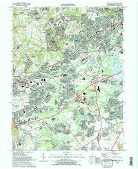
~ Newark East DE topo map, 1:24000 scale, 7.5 X 7.5 Minute, Historical, 1993, updated 1993
Newark East, Delaware, USGS topographic map dated 1993.
Includes geographic coordinates (latitude and longitude). This topographic map is suitable for hiking, camping, and exploring, or framing it as a wall map.
Printed on-demand using high resolution imagery, on heavy weight and acid free paper, or alternatively on a variety of synthetic materials.
Topos available on paper, Waterproof, Poly, or Tyvek. Usually shipping rolled, unless combined with other folded maps in one order.
- Product Number: USGS-5390154
- Free digital map download (high-resolution, GeoPDF): Newark East, Delaware (file size: 17 MB)
- Map Size: please refer to the dimensions of the GeoPDF map above
- Weight (paper map): ca. 55 grams
- Map Type: POD USGS Topographic Map
- Map Series: HTMC
- Map Verison: Historical
- Cell ID: 31899
- Scan ID: 255627
- Imprint Year: 1993
- Woodland Tint: Yes
- Visual Version Number: 2
- Aerial Photo Year: 1989
- Edit Year: 1993
- Field Check Year: 1991
- Datum: NAD83
- Map Projection: Universal Transverse Mercator
- Map published by United States Geological Survey
- Map Language: English
- Scanner Resolution: 600 dpi
- Map Cell Name: Newark East
- Grid size: 7.5 X 7.5 Minute
- Date on map: 1993
- Map Scale: 1:24000
- Geographical region: Delaware, United States
Neighboring Maps:
All neighboring USGS topo maps are available for sale online at a variety of scales.
Spatial coverage:
Topo map Newark East, Delaware, covers the geographical area associated the following places:
- Red Mills Farms - The Hills of Skyline - Centennial Village - Weatherhill Farms - Brandywine Springs Manor - Old Mill Manor - Raintree Village - The Pines of Pike Creek - Edgebrooke - Milford Meadows - Ruthby - Fairwinds - Fox Chase Park - West Meadow - Faulkland Woods - Marshallton Heights II - Parkwood - Princeton Wood II - Greenleaf Manor - Rivers End - Taylortown - Linden Heath - Carousel Knoll - Concord Towers - Fairwinds Mobile Home Park - Mermaid Run - Ivy Ridge - Drummond Ridge - Arbor Pointe Apartments - Pigeon Run - Pepper Ridge - Linden Green Apartment - Newkirk Estates - Harmony - Elmwood - Plum Run - Monterey Farms - Woodcreek - Delaplane Manor - Catalina Gardens - Kimberton - Limestone Gardene - Wellington Woods - Glendale - Skyline Ridge - Milford Crossroads - Sycamore Gardens - Westfield - Coach Hill - Montclare - Dunlinden Acres - Sherwood Forest - Harmony Hills - Fairway Falls - Pleasant Hill - Pendrew Manor - Bear - Drummond North - Piermont Woods - The Villa - Albertson - Lindell Village - Milltown - Heritage Farms - Whilton - Greenbridge - Eastburn Heights - Village of Cantebury - Stones Throw - Maplecrest - Eastburn Farms - Chestnut Hill Estates - Windy Hills - Pennock - Heather Woods - Jamestowne - Pleasantville - Greenbridge - Rolling Hills - Coventry - Albion - Washington Heights - Faulkland Heights - Brandywine Springs - Grendon Farms - The Bluffs - Mermaid - Pine Swamp Corner - Stones Throw - Limestone Acres - The Woods - The Village of Drummond Hill - Capital Trail Farms - Yorkshire - Kiamensi Gardens - Stanton Estates - Henderson Heights - Redmont - Heritage - Stanton
- Map Area ID: AREA39.7539.625-75.75-75.625
- Northwest corner Lat/Long code: USGSNW39.75-75.75
- Northeast corner Lat/Long code: USGSNE39.75-75.625
- Southwest corner Lat/Long code: USGSSW39.625-75.75
- Southeast corner Lat/Long code: USGSSE39.625-75.625
- Northern map edge Latitude: 39.75
- Southern map edge Latitude: 39.625
- Western map edge Longitude: -75.75
- Eastern map edge Longitude: -75.625


