
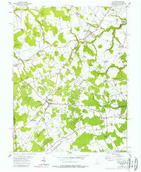
~ Kenton DE topo map, 1:24000 scale, 7.5 X 7.5 Minute, Historical, 1955, updated 1989
Kenton, Delaware, USGS topographic map dated 1955.
Includes geographic coordinates (latitude and longitude). This topographic map is suitable for hiking, camping, and exploring, or framing it as a wall map.
Printed on-demand using high resolution imagery, on heavy weight and acid free paper, or alternatively on a variety of synthetic materials.
Topos available on paper, Waterproof, Poly, or Tyvek. Usually shipping rolled, unless combined with other folded maps in one order.
- Product Number: USGS-5390054
- Free digital map download (high-resolution, GeoPDF): Kenton, Delaware (file size: 13 MB)
- Map Size: please refer to the dimensions of the GeoPDF map above
- Weight (paper map): ca. 55 grams
- Map Type: POD USGS Topographic Map
- Map Series: HTMC
- Map Verison: Historical
- Cell ID: 23368
- Scan ID: 255573
- Imprint Year: 1989
- Woodland Tint: Yes
- Photo Inspection Year: 1977
- Aerial Photo Year: 1977
- Edit Year: 1955
- Survey Year: 1926
- Datum: NAD27
- Map Projection: Polyconic
- Map published by United States Geological Survey
- Map Language: English
- Scanner Resolution: 600 dpi
- Map Cell Name: Kenton
- Grid size: 7.5 X 7.5 Minute
- Date on map: 1955
- Map Scale: 1:24000
- Geographical region: Delaware, United States
Neighboring Maps:
All neighboring USGS topo maps are available for sale online at a variety of scales.
Spatial coverage:
Topo map Kenton, Delaware, covers the geographical area associated the following places:
- Pearsons Corner - Bethesda - Everetts Corner - Davis Corner - Reynard Crossing - Rehak - Bechers Brook - Forrest Grove Village Mobile Home Park - Whigville - Underwood Corner - Forest Gate - Hourglass - Wrights Crossroads - Fords Corner - Rolling Meadows - Dinahs Corner - Downs Chapel - Shaws Corner - Oak Forest Estates - Hartly - Shorts Corner - Kenton - Warrens Mobile Home Park - Seven Hickories - Seeneytown - Hidden Acres - Slaughter - Green Briar
- Map Area ID: AREA39.2539.125-75.75-75.625
- Northwest corner Lat/Long code: USGSNW39.25-75.75
- Northeast corner Lat/Long code: USGSNE39.25-75.625
- Southwest corner Lat/Long code: USGSSW39.125-75.75
- Southeast corner Lat/Long code: USGSSE39.125-75.625
- Northern map edge Latitude: 39.25
- Southern map edge Latitude: 39.125
- Western map edge Longitude: -75.75
- Eastern map edge Longitude: -75.625


