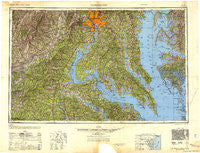
~ Washington DC topo map, 1:250000 scale, 1 X 2 Degree, Historical, 1948, updated 1948
Washington, District of Columbia, USGS topographic map dated 1948.
Includes geographic coordinates (latitude and longitude). This topographic map is suitable for hiking, camping, and exploring, or framing it as a wall map.
Printed on-demand using high resolution imagery, on heavy weight and acid free paper, or alternatively on a variety of synthetic materials.
Topos available on paper, Waterproof, Poly, or Tyvek. Usually shipping rolled, unless combined with other folded maps in one order.
- Product Number: USGS-5389878
- Free digital map download (high-resolution, GeoPDF): Washington, District of Columbia (file size: 17 MB)
- Map Size: please refer to the dimensions of the GeoPDF map above
- Weight (paper map): ca. 55 grams
- Map Type: POD USGS Topographic Map
- Map Series: HTMC
- Map Verison: Historical
- Cell ID: 69087
- Scan ID: 707833
- Imprint Year: 1948
- Woodland Tint: Yes
- Aerial Photo Year: 1944
- Datum: NAD27
- Map Projection: Transverse Mercator
- Map published by United States Army
- Map Language: English
- Scanner Resolution: 508 dpi
- Map Cell Name: Washington
- Grid size: 1 X 2 Degree
- Date on map: 1948
- Map Scale: 1:250000
- Geographical region: District of Columbia, United States
Neighboring Maps:
All neighboring USGS topo maps are available for sale online at a variety of scales.
Spatial coverage:
Topo map Washington, District of Columbia, covers the geographical area associated the following places:
- Wildcat Corner - Island View - Saint Clement Shores - Chapalita - Century Manor - Little Falls - Chester - Palmers Crossroads - Kings Retreat - Queens Guard - Old Trap - Butzner Corner - Romar Estates - Owens - River Springs - Youngsborough (historical) - Lothian Woods - Whitehall Manor - Beverly Forest - Austin Ridge - Colebrooke - Preston Point - Sunderlandville (historical) - Carrico - Rogers Heights - Westboro - Compton - Bowen Estates - Northern View Estates - Meter - Fairlee - Hampshire Knolls - Huntington Townhouses - Cedarlea - Willowbrook Hills - Shepherd Park - Port Aquia - Courthouse Square at Stafford - Herring Creek - Highland - Kennard Ridge - Marbury - Chalk Point - Jermantown - Yates Village - Independence Village - O Bannon Land - Lees Corner - Robbins Landing - Manors at Greenridge - The Ridges - Kent Square - Zulla - Crestview - Londonderry - Beach Harbor Mobile Home Park - Rosslyn - Springfield Station - Lusby Crossroads - Land Tree - Kentwood - Denby Hill - Summerville (historical) - Holland Glenn - Montyville Estates - Chesterwood - Mayfair-Parkside - Town Point Estates - East Central - Deacon Road Estates - Pawpaw Hollow - Meadow Oaks - Tyler Park - Upper Jutland - Elgin Corner - Indiantown - Summerseat Village - Wuthering Heights - Mattox Bridge - West Gate of Lomond - Sayers Forest - Marlow Heights - Bel Air - Laurel Hill - Colonial Heights - Land-O-Lakes - Hartwood Meadows - Port Tobacco - Holly Landing - Midway Estates - Tohoga (historical) - Whitestone - Garden Estates - Deep Harbour Farm Estates - Franklin Forest - Sligo - Ridgedale - Brightwood Park - Calvert Manor - Woodridge
- Map Area ID: AREA3938-78-76
- Northwest corner Lat/Long code: USGSNW39-78
- Northeast corner Lat/Long code: USGSNE39-76
- Southwest corner Lat/Long code: USGSSW38-78
- Southeast corner Lat/Long code: USGSSE38-76
- Northern map edge Latitude: 39
- Southern map edge Latitude: 38
- Western map edge Longitude: -78
- Eastern map edge Longitude: -76