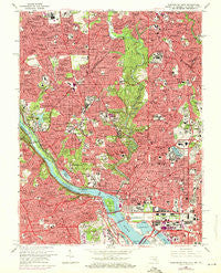
~ Washington West DC topo map, 1:24000 scale, 7.5 X 7.5 Minute, Historical, 1965, updated 1971
Washington West, District of Columbia, USGS topographic map dated 1965.
Includes geographic coordinates (latitude and longitude). This topographic map is suitable for hiking, camping, and exploring, or framing it as a wall map.
Printed on-demand using high resolution imagery, on heavy weight and acid free paper, or alternatively on a variety of synthetic materials.
Topos available on paper, Waterproof, Poly, or Tyvek. Usually shipping rolled, unless combined with other folded maps in one order.
- Product Number: USGS-5389842
- Free digital map download (high-resolution, GeoPDF): Washington West, District of Columbia (file size: 21 MB)
- Map Size: please refer to the dimensions of the GeoPDF map above
- Weight (paper map): ca. 55 grams
- Map Type: POD USGS Topographic Map
- Map Series: HTMC
- Map Verison: Historical
- Cell ID: 47611
- Scan ID: 256986
- Imprint Year: 1971
- Woodland Tint: Yes
- Photo Revision Year: 1971
- Aerial Photo Year: 1971
- Edit Year: 1965
- Field Check Year: 1956
- Datum: NAD27
- Map Projection: Polyconic
- Map published by United States Geological Survey
- Map Language: English
- Scanner Resolution: 600 dpi
- Map Cell Name: Washington West
- Grid size: 7.5 X 7.5 Minute
- Date on map: 1965
- Map Scale: 1:24000
- Geographical region: District of Columbia, United States
Neighboring Maps:
All neighboring USGS topo maps are available for sale online at a variety of scales.
Spatial coverage:
Topo map Washington West, District of Columbia, covers the geographical area associated the following places:
- Sutton Place - Sligo Park Hills - Rivercrest - Senate Heights - Chevy Chase Section Three - Capitol Hill - Hampshire Knolls - Chevy Chase - Dupont Circle - Indian Rock Terrace - Woodley Park - Washington - Bradmoor - Drummond - LeDroit Park - Foxhall - Reno - Sauis Addition (historical) - Carrollsburg (historical) - East End - Burleith - Fairview Heights (historical) - Westmoreland Terrace - Springfield - Martins Additions - Kalorama Triangle - North Gate - Glenbrook - Landon Village - Forest Hills - Shepherd Park - Chevy Chase Heights - Widowsville (historical) - Carroll Manor - Chevy Chase Lake - Kenwood - Tenleytown - Brightwood Park - Chinatown - Chillum Station - Glen Cove - Woodmont - Scott Circle - Park View - The Cloisters - Brinetown (historical) - Metropolis View - Foxhall Crescent - Lewis Subdivision (historical) - Barnaby Woods - Kent - Fort Myer Heights - Mount Pleasant - Cloisters - McLean Gardens - Woodmont - Dominion Heights - Lamond Riggs - Southwest - Chevy Chase Section 4 - Greenwich Forest - Sheridan-Kalorama - Wood Acres - Glover Park - Silver Spring - Broyhill Forest - Chevy Chase Section Five - Westover Place - Truxton Circle - Huntington Terrace - Beechwood Hills - Glenbrook Knoll - Martins Addition - Glenwood - Chevy Chase Village - Somerset Heights - Sumner - Edgewood - The Palisades - Embassy Park - Armsleigh Park (historical) - Westchester - Dover - North Takoma Park - Spring Valley - Cherrydale - Brandon Village - Silver Spring Park - Colony Hill - Massachusetts Avenue Heights - Friendship Village - Mount Vernon Square - Pinehurst Circle - Rosedale Park - Thomas Circle - West Chevy Chase Heights - Bethesda - Whitehall Manor - Tohoga (historical) - Foggy Bottom
- Map Area ID: AREA3938.875-77.125-77
- Northwest corner Lat/Long code: USGSNW39-77.125
- Northeast corner Lat/Long code: USGSNE39-77
- Southwest corner Lat/Long code: USGSSW38.875-77.125
- Southeast corner Lat/Long code: USGSSE38.875-77
- Northern map edge Latitude: 39
- Southern map edge Latitude: 38.875
- Western map edge Longitude: -77.125
- Eastern map edge Longitude: -77