
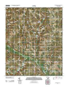
~ Pond Branch SC topo map, 1:24000 scale, 7.5 X 7.5 Minute, Historical, 2011
Pond Branch, South Carolina, USGS topographic map dated 2011.
Includes geographic coordinates (latitude and longitude). This topographic map is suitable for hiking, camping, and exploring, or framing it as a wall map.
Printed on-demand using high resolution imagery, on heavy weight and acid free paper, or alternatively on a variety of synthetic materials.
Topos available on paper, Waterproof, Poly, or Tyvek. Usually shipping rolled, unless combined with other folded maps in one order.
- Product Number: USGS-5389800
- Free digital map download (high-resolution, GeoPDF): Pond Branch, South Carolina (file size: 21 MB)
- Map Size: please refer to the dimensions of the GeoPDF map above
- Weight (paper map): ca. 55 grams
- Map Type: POD USGS Topographic Map
- Map Series: US Topo
- Map Verison: Historical
- Cell ID: 35937
- Datum: North American Datum of 1983
- Map Projection: Transverse Mercator
- Map Cell Name: Pond Branch
- Grid size: 7.5 X 7.5 Minute
- Date on map: 2011
- Map Scale: 1:24000
- Geographical region: South Carolina, United States
Neighboring Maps:
All neighboring USGS topo maps are available for sale online at a variety of scales.
Spatial coverage:
Topo map Pond Branch, South Carolina, covers the geographical area associated the following places:
- Pond Branch - Jeffcoat Bridge - Maloney Church - North Edisto School - Salem Church - Hooker Cemetery - South Carolina Noname 02027 D-2052 Dam - Pooles Millpond - South Carolina Noname 02030 D-2051 Dam - Neese Cemetery - Chapel Hill Baptist Church Cemetery - Hunter Branch - Lexington County Fire Service Mack Edisto - Culler Pond - Darlan School - Kings Pond - Corinth Church - Jeffcoat - Chaney Cemetery - Macks School (historical) - Hall Hill Church - Leffcoots Millpond - Salem Baptist Church Cemetery - Brooker Pond - Pooles Upper Millpond - Little Hollow Creek - Maloney School (historical) - Chapel Hill Baptist Church Cemetery - Leaird Cemetery - Pooles Upper Millpond - Livingston Mill (historical) - Pooles Millpond - Bodie School (historical) - Crawford Branch - Salem Creek - Central Hill School (historical) - Culler Ponds - South Carolina Noname 32079 D-1005 Dam - Hollow Creek Fire Department - Shumpert Pond - Jacksons Pond - Caughman Lake - Ebenezer Methodist Church - Chapel Hill Church - Central Church - Jackson Branch - Jerusalem Church - Corbett Lake - South Carolina Noname 32022 D-0980 Dam - Swansea Evangelical Church - Mount Beulah School (historical) - South Carolina Noname 02094 D-2164 Dam - Pleasant Hill School (historical) - Hollow Creek - Saint Paul Church - Thrasher Branch - Kings Grove Church - South Carolina Noname 38070 D-3682 Dam - South Carolina Noname 32023 D-1004 Dam
- Map Area ID: AREA33.7533.625-81.25-81.125
- Northwest corner Lat/Long code: USGSNW33.75-81.25
- Northeast corner Lat/Long code: USGSNE33.75-81.125
- Southwest corner Lat/Long code: USGSSW33.625-81.25
- Southeast corner Lat/Long code: USGSSE33.625-81.125
- Northern map edge Latitude: 33.75
- Southern map edge Latitude: 33.625
- Western map edge Longitude: -81.25
- Eastern map edge Longitude: -81.125


