
~ Powell Mountain OR topo map, 1:24000 scale, 7.5 X 7.5 Minute, Historical, 2011
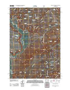
Powell Mountain, Oregon, USGS topographic map dated 2011.
Includes geographic coordinates (latitude and longitude). This topographic map is suitable for hiking, camping, and exploring, or framing it as a wall map.
Printed on-demand using high resolution imagery, on heavy weight and acid free paper, or alternatively on a variety of synthetic materials.
Topos available on paper, Waterproof, Poly, or Tyvek. Usually shipping rolled, unless combined with other folded maps in one order.
- Product Number: USGS-5389614
- Free digital map download (high-resolution, GeoPDF): Powell Mountain, Oregon (file size: 18 MB)
- Map Size: please refer to the dimensions of the GeoPDF map above
- Weight (paper map): ca. 55 grams
- Map Type: POD USGS Topographic Map
- Map Series: US Topo
- Map Verison: Historical
- Cell ID: 36268
- Datum: North American Datum of 1983
- Map Projection: Transverse Mercator
- Map Cell Name: Powell Mountain
- Grid size: 7.5 X 7.5 Minute
- Date on map: 2011
- Map Scale: 1:24000
- Geographical region: Oregon, United States
Neighboring Maps:
All neighboring USGS topo maps are available for sale online at a variety of scales.
Spatial coverage:
Topo map Powell Mountain, Oregon, covers the geographical area associated the following places:
- Thompson Reservoir - Telephone Spring - Bellworm Canyon - Rock Spring Reservoir - Bellworm Reservoir - Powell Valley - Boundary Reservoir - Humphrey Ranch - Cold Spring - Division Reservoir - Powell Ranch - Rager Creek - Duck Puddle Reservoir - Beaverdam Creek - Bob Spring - Heisler Creek - Bronco Creek - Sunflower Flats - Powell Creek - Upper Bronco Reservoir - Ashley Ridge - Ochoco National Forest Paulina Ranger District - Suplee Spring - Bear Butte - Bronco Reservoir - Heisler Reservoir Number Two - Black Stump Creek - Palmer Reservoir - Pine Tree Reservoir - Monroe Draw - Stump Creek Reservoir - Turnpike Reservoir - Hardscrabble Ridge - Hawk Reservoir - Palmer Ditch - Rager Spring - Middle Bronco Reservoir - Tamarack Creek - Christiansen Lake - Powell Mountain - Bear Creek - Heisler Reservoir Number One - Palmer Ranch - Treichel Ridge - Bear Butte Reservoir - Stockade Point
- Map Area ID: AREA44.2544.125-119.75-119.625
- Northwest corner Lat/Long code: USGSNW44.25-119.75
- Northeast corner Lat/Long code: USGSNE44.25-119.625
- Southwest corner Lat/Long code: USGSSW44.125-119.75
- Southeast corner Lat/Long code: USGSSE44.125-119.625
- Northern map edge Latitude: 44.25
- Southern map edge Latitude: 44.125
- Western map edge Longitude: -119.75
- Eastern map edge Longitude: -119.625


