
~ Eagle Butte OR topo map, 1:24000 scale, 7.5 X 7.5 Minute, Historical, 2011
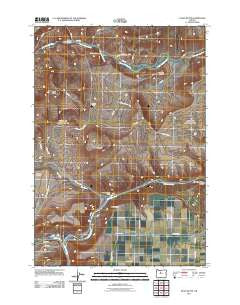
Eagle Butte, Oregon, USGS topographic map dated 2011.
Includes geographic coordinates (latitude and longitude). This topographic map is suitable for hiking, camping, and exploring, or framing it as a wall map.
Printed on-demand using high resolution imagery, on heavy weight and acid free paper, or alternatively on a variety of synthetic materials.
Topos available on paper, Waterproof, Poly, or Tyvek. Usually shipping rolled, unless combined with other folded maps in one order.
- Product Number: USGS-5389268
- Free digital map download (high-resolution, GeoPDF): Eagle Butte, Oregon (file size: 18 MB)
- Map Size: please refer to the dimensions of the GeoPDF map above
- Weight (paper map): ca. 55 grams
- Map Type: POD USGS Topographic Map
- Map Series: US Topo
- Map Verison: Historical
- Cell ID: 13231
- Datum: North American Datum of 1983
- Map Projection: Transverse Mercator
- Map Cell Name: Eagle Butte
- Grid size: 7.5 X 7.5 Minute
- Date on map: 2011
- Map Scale: 1:24000
- Geographical region: Oregon, United States
Neighboring Maps:
All neighboring USGS topo maps are available for sale online at a variety of scales.
Spatial coverage:
Topo map Eagle Butte, Oregon, covers the geographical area associated the following places:
- Shitike Creek - Dry Creek Cemetery - Mecca Grade - Mecca Flat Boat Ramp - Tee Wees Butte - Hot Springs Cemetery - Warm Springs Forest Products 1 - 3 Biomass Facility - Dry Creek - Dry Creek Horse Camp - Indian Head Canyon - Kahneeta Hot Spring - Warm Springs Boat Ramp - Mecca - Mecca Post Office (historical) - Kah-Nee-Ta Resort - Warm Springs National Fish Hatchery - McKinley Corral - Warm Springs State Recreation Site (historical) - Eagle Butte
- Map Area ID: AREA44.87544.75-121.25-121.125
- Northwest corner Lat/Long code: USGSNW44.875-121.25
- Northeast corner Lat/Long code: USGSNE44.875-121.125
- Southwest corner Lat/Long code: USGSSW44.75-121.25
- Southeast corner Lat/Long code: USGSSE44.75-121.125
- Northern map edge Latitude: 44.875
- Southern map edge Latitude: 44.75
- Western map edge Longitude: -121.25
- Eastern map edge Longitude: -121.125


