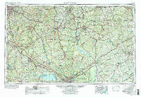
~ Spartanburg SC topo map, 1:250000 scale, 1 X 2 Degree, Historical, 1953, updated 1988
Spartanburg, South Carolina, USGS topographic map dated 1953.
Includes geographic coordinates (latitude and longitude). This topographic map is suitable for hiking, camping, and exploring, or framing it as a wall map.
Printed on-demand using high resolution imagery, on heavy weight and acid free paper, or alternatively on a variety of synthetic materials.
Topos available on paper, Waterproof, Poly, or Tyvek. Usually shipping rolled, unless combined with other folded maps in one order.
- Product Number: USGS-5389172
- Free digital map download (high-resolution, GeoPDF): Spartanburg, South Carolina (file size: 22 MB)
- Map Size: please refer to the dimensions of the GeoPDF map above
- Weight (paper map): ca. 55 grams
- Map Type: POD USGS Topographic Map
- Map Series: HTMC
- Map Verison: Historical
- Cell ID: 74963
- Scan ID: 262057
- Imprint Year: 1988
- Woodland Tint: Yes
- Edit Year: 1969
- Field Check Year: 1953
- Datum: Unstated
- Map Projection: Transverse Mercator
- Map published by United States Geological Survey
- Map Language: English
- Scanner Resolution: 600 dpi
- Map Cell Name: Spartanburg
- Grid size: 1 X 2 Degree
- Date on map: 1953
- Map Scale: 1:250000
- Geographical region: South Carolina, United States
Neighboring Maps:
All neighboring USGS topo maps are available for sale online at a variety of scales.
Spatial coverage:
Topo map Spartanburg, South Carolina, covers the geographical area associated the following places:
- High Point - Oswald Park - Cool Springs - DuBose Crossroads - Wolfville (historical) - York - Southern Shops - Blairsville - Eau Claire - Johnson City - Sutton Spring (historical) - Winnsboro - Cartersville - Whites Crossroads - Monroe - Sardis - Hammond - College Heights - Green Valley - Midway - Smith Ford - Starmount Acres - Delta - Kirkover Hills - Hermitage Mill - Columbia - Clinton Park - Taylors Crossroads - Sturgis Estates - New Hill - Foxhall - Branham Heights - Carmel Village - Wintercrest - Millbank (historical) - Cherry Hill - Tickle Hill - Springdell - Pacolet - Hutchinson Acres - Ragin Estates - Fosters Crossroads - Tabernacle (historical) - Wedgewood - Cravenhill (historical) - Smiths Tavern - Granthams Crossroads - Marshville - Jug Hole - Swan Meadows - Grindall (historical) - Flinns Crossroads - Spring Lake - Bascomville - Spring Valley - Irwin - Fairfield Terrace - Clear Springs - Pine Forest - Bailey Town (historical) - Woodvale - Windsor Estates - Rock Rest - Glendale - Phyllis Goins Court - Belleview - Calvin (historical) - Woodland Forest - Green Valley Estates - Horatio - Shiland Hills - Antioch - Minton Mill - Arlington Estates - Kilbourne Heights - Ridgewood Heights - Monticello - Grenadier - Peak - Boney - Moore - Forest Acres - Kimberly Woods - Lylesford (historical) - Warrington - Sharon - Ingrams - Thursa - Fairwold - Jefferson - Flint Hill - Shannon Hill - Hollywood Point - Catoe (historical) - Erwin Park - White Bluff Corssroads - Lattakoo (historical) - Woodfield Park - Belmont - Oasis Trailer Park
- Map Area ID: AREA3534-82-80
- Northwest corner Lat/Long code: USGSNW35-82
- Northeast corner Lat/Long code: USGSNE35-80
- Southwest corner Lat/Long code: USGSSW34-82
- Southeast corner Lat/Long code: USGSSE34-80
- Northern map edge Latitude: 35
- Southern map edge Latitude: 34
- Western map edge Longitude: -82
- Eastern map edge Longitude: -80

