
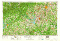
~ Greenville SC topo map, 1:250000 scale, 1 X 2 Degree, Historical, 1954, updated 1965
Greenville, South Carolina, USGS topographic map dated 1954.
Includes geographic coordinates (latitude and longitude). This topographic map is suitable for hiking, camping, and exploring, or framing it as a wall map.
Printed on-demand using high resolution imagery, on heavy weight and acid free paper, or alternatively on a variety of synthetic materials.
Topos available on paper, Waterproof, Poly, or Tyvek. Usually shipping rolled, unless combined with other folded maps in one order.
- Product Number: USGS-5389150
- Free digital map download (high-resolution, GeoPDF): Greenville, South Carolina (file size: 26 MB)
- Map Size: please refer to the dimensions of the GeoPDF map above
- Weight (paper map): ca. 55 grams
- Map Type: POD USGS Topographic Map
- Map Series: HTMC
- Map Verison: Historical
- Cell ID: 68808
- Scan ID: 262046
- Imprint Year: 1965
- Woodland Tint: Yes
- Edit Year: 1964
- Datum: Unstated
- Map Projection: Transverse Mercator
- Map published by United States Geological Survey
- Map published by United States Army Corps of Engineers
- Map Language: English
- Scanner Resolution: 600 dpi
- Map Cell Name: Greenville
- Grid size: 1 X 2 Degree
- Date on map: 1954
- Map Scale: 1:250000
- Geographical region: South Carolina, United States
Neighboring Maps:
All neighboring USGS topo maps are available for sale online at a variety of scales.
Spatial coverage:
Topo map Greenville, South Carolina, covers the geographical area associated the following places:
- James Spring (historical) - Laura (historical) - Berea - Royal Acres - Burton Junction (historical) - Bradley Corner - Northgate - Grove Level - Normandy Park - Clemson Gardens - Cambridge Place - Spring Forest - Briarcliff - Brewerton - Brittany Park - Keystone Acres - Watson Estates - George Martin Acres - Reed - Oxford - Lakefront - Balus Creek - Reidville Acres - Forest Hills - Waterford - Woodbridge - Timberlake - Christopher Heights - Millwood (historical) - Silver Leaf - Harvest - McKelvey Crossroads - Trail Creek Estates Mobile Home Park - Reeds - Price - Salak - Rocky River (historical) - Pearidge - Hillandale - Cherokee Hills - Northview Acres - Kingsberry - Level Land - Windtree - Meadow Brook - Five Forks - Monaghan - Trackrock (historical) - Green Meadows - Fair Play - Sugar Creek - Whitmire - Marilyn Acres - Cleveland Forest - Summer Place - Homer - Wade Hampton Gardens - Brookwood Forest - Quiet Place in the Woods - Oscarville - Riverbend - Smithfields - Seymours Store - Brookwood - Pritchard Creek - North Forest Estates - Flat Shoals - Helen - Oakwood - Regency Park - Bentwood - Regency Woods - Hughes Heights - Beaver Pond - Cateechee - Laurel Falls - Springdale - Edinburg (historical) - Marcus (historical) - Silk Mills - Wild Fern - Cherokee Forest - Easley - Newry - Land (historical) - Forestdale Heights - Broadleaf Acres - Springlake Estates - Algary (historical) - Lawson Highlands - Cascade Woods - Longview - Saxony Forest - Lake Barcroft Acres - Cove Subdivision - Water Plantation - Whitehall - Griffin Heights - Fairmont Mills - Poinsettia
- Map Area ID: AREA3534-84-82
- Northwest corner Lat/Long code: USGSNW35-84
- Northeast corner Lat/Long code: USGSNE35-82
- Southwest corner Lat/Long code: USGSSW34-84
- Southeast corner Lat/Long code: USGSSE34-82
- Northern map edge Latitude: 35
- Southern map edge Latitude: 34
- Western map edge Longitude: -84
- Eastern map edge Longitude: -82


