
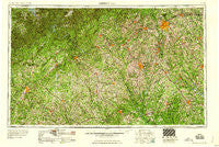
~ Greenville SC topo map, 1:250000 scale, 1 X 2 Degree, Historical, 1958, updated 1958
Greenville, South Carolina, USGS topographic map dated 1958.
Includes geographic coordinates (latitude and longitude). This topographic map is suitable for hiking, camping, and exploring, or framing it as a wall map.
Printed on-demand using high resolution imagery, on heavy weight and acid free paper, or alternatively on a variety of synthetic materials.
Topos available on paper, Waterproof, Poly, or Tyvek. Usually shipping rolled, unless combined with other folded maps in one order.
- Product Number: USGS-5389148
- Free digital map download (high-resolution, GeoPDF): Greenville, South Carolina (file size: 28 MB)
- Map Size: please refer to the dimensions of the GeoPDF map above
- Weight (paper map): ca. 55 grams
- Map Type: POD USGS Topographic Map
- Map Series: HTMC
- Map Verison: Historical
- Cell ID: 68808
- Scan ID: 262045
- Imprint Year: 1958
- Woodland Tint: Yes
- Datum: Unstated
- Map Projection: Transverse Mercator
- Map published by United States Geological Survey
- Map published by United States Army Corps of Engineers
- Map Language: English
- Scanner Resolution: 600 dpi
- Map Cell Name: Greenville
- Grid size: 1 X 2 Degree
- Date on map: 1958
- Map Scale: 1:250000
- Geographical region: South Carolina, United States
Neighboring Maps:
All neighboring USGS topo maps are available for sale online at a variety of scales.
Spatial coverage:
Topo map Greenville, South Carolina, covers the geographical area associated the following places:
- Woodhedge - Ashley Downs - Velpoe - Cross Roads - Marshall Heights - West Union - Augusta Acres - Town Creek - Fairview - Simpsonville - Carver Park - Promised Land - Woodland Homes - Northcliff Colony - Choestoe - Liberty - Oglesby - Cheohee - Forest View - Pritchard Creek - Gilstrap - Paris Point - Park Place - Lanier North Woods - Meadowood - Squirrel Creek - Harbin (historical) - Gay Lan - Oakdale - Millers Mill - Cavalier Woods - Nevitt Woods - Gray Court - Holiday Meadows - Wedgefield - Hillandale - Burris - Sans Souci - Cardinal Park - North Forest - Laurel Falls - Dowdy (historical) - Green Forest - Uvena - Wolfs Head - Woodland Village - Highland Acres - Gluck - College Heights - Mooney - Rock Creek Acres - Pine Forest - Country Homes - Donalds - Chick Springs - Pine Land Shores - Hamilton Trailer Park - Varennes Heights - Richmond Hills - Sadler (historical) - Eastminster - Antioch - Pine Knott Forest - Piedmont - Quail Run - Yonah - Carlton - Hester - Knollwood - Lickville - Sells - Planter - Twin Lakes - Lyman - West Pelzer - MacArthurs Junction - Tabor - Newry - Calvert - Forest Acres - Friendship - Concord - Old Mill Estates - Wellford - Beverly - Colony Subdivision - Homestead Acres - Cherokee Hills - Walhalla - Moody Cove - Stone Lake Heights - Shirley Grove - Gilmer Estates - Westgate - Marcus (historical) - Timberlake - Sallee Heights - Chesterfield Estates - Arborville - Isaqueena Village
- Map Area ID: AREA3534-84-82
- Northwest corner Lat/Long code: USGSNW35-84
- Northeast corner Lat/Long code: USGSNE35-82
- Southwest corner Lat/Long code: USGSSW34-84
- Southeast corner Lat/Long code: USGSSE34-82
- Northern map edge Latitude: 35
- Southern map edge Latitude: 34
- Western map edge Longitude: -84
- Eastern map edge Longitude: -82


