
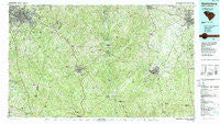
~ Spartanburg SC topo map, 1:100000 scale, 30 X 60 Minute, Historical, 1986, updated 1989
Spartanburg, South Carolina, USGS topographic map dated 1986.
Includes geographic coordinates (latitude and longitude). This topographic map is suitable for hiking, camping, and exploring, or framing it as a wall map.
Printed on-demand using high resolution imagery, on heavy weight and acid free paper, or alternatively on a variety of synthetic materials.
Topos available on paper, Waterproof, Poly, or Tyvek. Usually shipping rolled, unless combined with other folded maps in one order.
- Product Number: USGS-5389096
- Free digital map download (high-resolution, GeoPDF): Spartanburg, South Carolina (file size: 36 MB)
- Map Size: please refer to the dimensions of the GeoPDF map above
- Weight (paper map): ca. 55 grams
- Map Type: POD USGS Topographic Map
- Map Series: HTMC
- Map Verison: Historical
- Cell ID: 68394
- Scan ID: 262018
- Imprint Year: 1989
- Woodland Tint: Yes
- Aerial Photo Year: 1984
- Edit Year: 1986
- Datum: NAD27
- Map Projection: Universal Transverse Mercator
- Map published by United States Geological Survey
- Map Language: English
- Scanner Resolution: 600 dpi
- Map Cell Name: Spartanburg
- Grid size: 30 X 60 Minute
- Date on map: 1986
- Map Scale: 1:100000
- Geographical region: South Carolina, United States
Neighboring Maps:
All neighboring USGS topo maps are available for sale online at a variety of scales.
Spatial coverage:
Topo map Spartanburg, South Carolina, covers the geographical area associated the following places:
- Beaty Estates - Santuc - Tip Top (historical) - Huntington (historical) - Zion Hill - Central Pacolet - Rawlinson Acres - Sardis - Summerhill - Stringfellow - Wintercrest - Quail Run - Hub City Courts - Fairview Heights - Sedalia - Country Club Estates - Old Point Station - Goodwins Crossroads - Hobbyville - Williamsburg Estates - Evans - Park Hills - Cross Keys - Woodbridge - Mexico - Lockhart - Fairlawn - Church Hill Heights - Brooklyn - Ponderosa Gardens - Robat - Matthews Estates - Simmon Tree (historical) - Belvedere - Hayne Station - Branyon Heights - Sundance - Southport Estates - Glenwood (historical) - West View - Oakdale - Kelly - Smith Ford - Heatherwood - Rawlinson Woods - Cotton (historical) - Clarkson (historical) - Ora - Moore - Guthries - Blackstock - Cornwell - Phyllis Goins Court - Pebblebrook - Clubside Estates - Hartwell Courts - Avondale Terrace - Ruckers Crossroads - Brattonsville - Newport - Lewisville (historical) - Blairsville - Rock Hill - Adamsburg - Arcadia - Sedgefield - Frady's Mobile Home Park - Coventry Estates - Ebenezer - Miller Crossing - Forest Hills - Carlton Court - Red Town (historical) - Montgomery Acres - Flint Hill - Oak Hurst - Tirzah - Salem Estates - Brookwood - Long Branch - Heatherwood Mobile Home Park - Chester - White Stone Springs (historical) - Westerwood Acres - Winthrop Heights - Monarch - Stoneybrook Estates - Washington Heights - Lockhart Junction - Hoodtown - Cedar Forest Acres - Wilkinsville - Kilgore - Wildcat (historical) - Lanford - Sutton Spring (historical) - Sharon - Lewis - Bentway Park - Pinckney
- Map Area ID: AREA3534.5-82-81
- Northwest corner Lat/Long code: USGSNW35-82
- Northeast corner Lat/Long code: USGSNE35-81
- Southwest corner Lat/Long code: USGSSW34.5-82
- Southeast corner Lat/Long code: USGSSE34.5-81
- Northern map edge Latitude: 35
- Southern map edge Latitude: 34.5
- Western map edge Longitude: -82
- Eastern map edge Longitude: -81


