
~ Saint George SC topo map, 1:100000 scale, 30 X 60 Minute, Historical, 1985, updated 1986
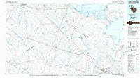
Saint George, South Carolina, USGS topographic map dated 1985.
Includes geographic coordinates (latitude and longitude). This topographic map is suitable for hiking, camping, and exploring, or framing it as a wall map.
Printed on-demand using high resolution imagery, on heavy weight and acid free paper, or alternatively on a variety of synthetic materials.
Topos available on paper, Waterproof, Poly, or Tyvek. Usually shipping rolled, unless combined with other folded maps in one order.
- Product Number: USGS-5389090
- Free digital map download (high-resolution, GeoPDF): Saint George, South Carolina (file size: 19 MB)
- Map Size: please refer to the dimensions of the GeoPDF map above
- Weight (paper map): ca. 55 grams
- Map Type: POD USGS Topographic Map
- Map Series: HTMC
- Map Verison: Historical
- Cell ID: 68280
- Scan ID: 262015
- Imprint Year: 1986
- Aerial Photo Year: 1983
- Edit Year: 1985
- Datum: NAD27
- Map Projection: Universal Transverse Mercator
- Planimetric: Yes
- Map published by United States Geological Survey
- Map Language: English
- Scanner Resolution: 600 dpi
- Map Cell Name: Saint George
- Grid size: 30 X 60 Minute
- Date on map: 1985
- Map Scale: 1:100000
- Geographical region: South Carolina, United States
Neighboring Maps:
All neighboring USGS topo maps are available for sale online at a variety of scales.
Spatial coverage:
Topo map Saint George, South Carolina, covers the geographical area associated the following places:
- Lincoln Green - Robynwyn - Williams - Knightsville - Tuckertown - Corona Park - Vance - Challendon - Stratford Forest - Tugtown - Green Hill (historical) - Colonial Heights - Edistone (historical) - Millwood - Mill Creek - Woodbridge - South Pointe - Cross - Duncan Chapel - Locklair (historical) - Lebanon - Pine Forest - Mount Pisgah - Murraysville - Beverly Hills - Long Ridge - Felder - Sugar Hill - Ridgeville - Embree - Ferguson (historical) - Hallmark Hills - Bowyer - Hope (historical) - Black Creek - Saint Julian - Holly Hill - Felderville - Mount Holly - Rivelon - Sugar Hill - Rosehill - Canadys - Ashton - Eutawville - Hussertown - Four Holes - Black Tom (historical) - Dorange - Holly Ridge - Pinopolis - Gadsden Place - Pigeon Bay (historical) - Spring Hill - Church Hill (historical) - Palmetto Park - Lincolnville - Beverly Hills - Moorefield - Bonneau Beach - Dorchester - Twin Lakes - Johnsville - Foxborough - Edisto - Murrell (historical) - Scotch Range Estates - Corsada (historical) - Tramway - Hillavista - Windwood - Gailmoor - Pinehill - Sawmill Terrace - Groomville - Cross Cross Roads - Washington Town - Chapel Hill (historical) - Giant - New Hope - Saint George - Inabinetts (historical) - Reevesville - Caldwell - Bull Station - Oak Hill - Wells - Waring Hall - Wing Road - Holly Court - Pine Forest Estates - Byrd - Shephard Park - Millersville (historical) - Brentwood - Oaks Crossroads - Saint Johns - Russell Lake Landing - Region Town (historical) - Haddock
- Map Area ID: AREA33.533-81-80
- Northwest corner Lat/Long code: USGSNW33.5-81
- Northeast corner Lat/Long code: USGSNE33.5-80
- Southwest corner Lat/Long code: USGSSW33-81
- Southeast corner Lat/Long code: USGSSE33-80
- Northern map edge Latitude: 33.5
- Southern map edge Latitude: 33
- Western map edge Longitude: -81
- Eastern map edge Longitude: -80


