
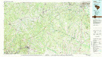
~ Aiken SC topo map, 1:100000 scale, 30 X 60 Minute, Historical, 1983, updated 1984
Aiken, South Carolina, USGS topographic map dated 1983.
Includes geographic coordinates (latitude and longitude). This topographic map is suitable for hiking, camping, and exploring, or framing it as a wall map.
Printed on-demand using high resolution imagery, on heavy weight and acid free paper, or alternatively on a variety of synthetic materials.
Topos available on paper, Waterproof, Poly, or Tyvek. Usually shipping rolled, unless combined with other folded maps in one order.
- Product Number: USGS-5389048
- Free digital map download (high-resolution, GeoPDF): Aiken, South Carolina (file size: 30 MB)
- Map Size: please refer to the dimensions of the GeoPDF map above
- Weight (paper map): ca. 55 grams
- Map Type: POD USGS Topographic Map
- Map Series: HTMC
- Map Verison: Historical
- Cell ID: 67017
- Scan ID: 261994
- Imprint Year: 1984
- Woodland Tint: Yes
- Aerial Photo Year: 1981
- Edit Year: 1983
- Datum: NAD27
- Map Projection: Universal Transverse Mercator
- Map published by United States Geological Survey
- Map Language: English
- Scanner Resolution: 600 dpi
- Map Cell Name: Aiken
- Grid size: 30 X 60 Minute
- Date on map: 1983
- Map Scale: 1:100000
- Geographical region: South Carolina, United States
Neighboring Maps:
All neighboring USGS topo maps are available for sale online at a variety of scales.
Spatial coverage:
Topo map Aiken, South Carolina, covers the geographical area associated the following places:
- Earle (historical) - Sweetwater - Hibernia - Summer Hill - Pine and Oak Woods - Harmony - Milledgeville (historical) - Apollo Gardens - Millbrook Estates - Eureka - Speigner - Highview (historical) - Merritts Bridge (historical) - Conger Woods - Lynwood - Greyland Forest - Congaree Gardens - Crystal View - Pinehurst - Monetta - Balltown - Martintowne - Arthurtown - Gatewood - Edmund - Barclay Park - Three Fountains - Westcliff Estates - Kitchings Mill - Lynnhurst - Fredonia - Gem Lake Estates - Elsie - River Bluff Estates - Six Points - Chaffee (historical) - Emory - Nicholson Village - Kalmia Landing - Shiloh Heights - Vaucluse - Horse Creek - Sandlewood - Montmorenci - Salley - Shandon - Melwood - Brogden - Clubhouse Crossroads - Woodsen - Peachtree Acres - Carolina Terrace - Silver Lake - Mathais Crossroads - Oak Grove - Leesville - Smithfield - Foxtown - Swearingen (historical) - Southwood - Ascaga Heights - Apia (historical) - Rainbow Falls - Ward Hills - Greenfield - Murphys Estates - Forrest Park - Crestdale - Cardinal Park - Hidden Haven - Charwood - Harrisburg - Blacks - Deerwood - Enos - Traus (historical) - Oak Crest - Johnston - North Augusta - Roseland - Dogwood Manor - Jones Crossroads - Wise (historical) - Hillside - Windtree - Westcliff - Seivern - Crosland Park - Augusta View Heights - Limp - Bahama Heights - Wrenwood - Fairview Crossroads - Owdoms - Bath - Barr Crossing - Lakewood - Thor - Land of the Lakes - Parkway Place
- Map Area ID: AREA3433.5-82-81
- Northwest corner Lat/Long code: USGSNW34-82
- Northeast corner Lat/Long code: USGSNE34-81
- Southwest corner Lat/Long code: USGSSW33.5-82
- Southeast corner Lat/Long code: USGSSE33.5-81
- Northern map edge Latitude: 34
- Southern map edge Latitude: 33.5
- Western map edge Longitude: -82
- Eastern map edge Longitude: -81


