
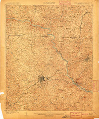
~ Gaffney SC topo map, 1:62500 scale, 15 X 15 Minute, Historical, 1909
Gaffney, South Carolina, USGS topographic map dated 1909.
Includes geographic coordinates (latitude and longitude). This topographic map is suitable for hiking, camping, and exploring, or framing it as a wall map.
Printed on-demand using high resolution imagery, on heavy weight and acid free paper, or alternatively on a variety of synthetic materials.
Topos available on paper, Waterproof, Poly, or Tyvek. Usually shipping rolled, unless combined with other folded maps in one order.
- Product Number: USGS-5388760
- Free digital map download (high-resolution, GeoPDF): Gaffney, South Carolina (file size: 11 MB)
- Map Size: please refer to the dimensions of the GeoPDF map above
- Weight (paper map): ca. 55 grams
- Map Type: POD USGS Topographic Map
- Map Series: HTMC
- Map Verison: Historical
- Cell ID: 54439
- Scan ID: 261845
- Survey Year: 1907
- Datum: Unstated
- Map Projection: Unstated
- Map published by United States Geological Survey
- Map Language: English
- Scanner Resolution: 600 dpi
- Map Cell Name: Gaffney
- Grid size: 15 X 15 Minute
- Date on map: 1909
- Map Scale: 1:62500
- Geographical region: South Carolina, United States
Neighboring Maps:
All neighboring USGS topo maps are available for sale online at a variety of scales.
Spatial coverage:
Topo map Gaffney, South Carolina, covers the geographical area associated the following places:
- Stuart Heights - Byersville (historical) - Briar Creek - Glenhaven - Gaston Shoals (historical) - Dogwood Springs Park - Rosehill Park - Buffalo - Arrowood - Canterbury - Country Club Estates - Connecticut Park - Cherokee Hills - Grassy Pond - Draytonville - Sharon - Westerly Park - Nicholsville (historical) - Goforth Cross Road (historical) - College Park - Garden Park - Dogwood Park - Wellington Manor - Buford Heights - Erwinsville (historical) - Forest Hills - York Hills - Belmont Acres - Wood Haven Park - Tanglewood - Blacksburg - Mercer (historical) - Huntington - Glenwood Estates - Forest Lake Homes - Patterson Springs - Shalimar - Maplewood - Easterly Heights - Rutledge Estates - Sulphur Springs - Hillbrook - Kings Park - Pleasant Meadows - Midway - Cashion Crossroads - East Gaffney - Beaverdam - Gaffney - Laurelwood - Quail Hollow - Lawn (historical) - Rutledge Acres - Carter Heights - Earl - Cherokee Falls - Penn Jones - Northgate - Hidden Acres Estates - Crestmont - Mount Sinai - Brookwood Estates - Thicketty - Harmony Hill - Maud
- Map Area ID: AREA35.2535-81.75-81.5
- Northwest corner Lat/Long code: USGSNW35.25-81.75
- Northeast corner Lat/Long code: USGSNE35.25-81.5
- Southwest corner Lat/Long code: USGSSW35-81.75
- Southeast corner Lat/Long code: USGSSE35-81.5
- Northern map edge Latitude: 35.25
- Southern map edge Latitude: 35
- Western map edge Longitude: -81.75
- Eastern map edge Longitude: -81.5


