
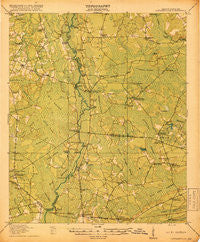
~ Cottageville SC topo map, 1:62500 scale, 15 X 15 Minute, Historical, 1918
Cottageville, South Carolina, USGS topographic map dated 1918.
Includes geographic coordinates (latitude and longitude). This topographic map is suitable for hiking, camping, and exploring, or framing it as a wall map.
Printed on-demand using high resolution imagery, on heavy weight and acid free paper, or alternatively on a variety of synthetic materials.
Topos available on paper, Waterproof, Poly, or Tyvek. Usually shipping rolled, unless combined with other folded maps in one order.
- Product Number: USGS-5388702
- Free digital map download (high-resolution, GeoPDF): Cottageville, South Carolina (file size: 8 MB)
- Map Size: please refer to the dimensions of the GeoPDF map above
- Weight (paper map): ca. 55 grams
- Map Type: POD USGS Topographic Map
- Map Series: HTMC
- Map Verison: Historical
- Cell ID: 52980
- Scan ID: 261813
- Woodland Tint: Yes
- Survey Year: 1918
- Datum: Unstated
- Map Projection: Unstated
- Map published by United States Army Corps of Engineers
- Map published by United States Department of War
- Map Language: English
- Scanner Resolution: 600 dpi
- Map Cell Name: Cottageville
- Grid size: 15 X 15 Minute
- Date on map: 1918
- Map Scale: 1:62500
- Geographical region: South Carolina, United States
Neighboring Maps:
All neighboring USGS topo maps are available for sale online at a variety of scales.
Spatial coverage:
Topo map Cottageville, South Carolina, covers the geographical area associated the following places:
- Canady Landing - Gettysville - Norman Landing - Parkers Ferry Landing - Warren Crossroads - Red Oak Corner - Osborn - Beck Landing - Kelsey Cove Landing - Padgett Landing - Long Creek Landing - Jericho - Winwright (historical) - Ponpon - Burnt Church Crossroads - Goodhope Landing - Jacksonboro - Canaan - Metz Store (historical) - Coachmans Corners - Pine Hill Landing - Waringville (historical) - Ravenel - Prices Landing - Lowndes Landing - Capwells Crossroads - Delemar Crossroads - Cottageville - Gloverville - Clubhouse Crossroads - Parkers Ferry - Iron Crossroads - Martins Landing
- Map Area ID: AREA3332.75-80.5-80.25
- Northwest corner Lat/Long code: USGSNW33-80.5
- Northeast corner Lat/Long code: USGSNE33-80.25
- Southwest corner Lat/Long code: USGSSW32.75-80.5
- Southeast corner Lat/Long code: USGSSE32.75-80.25
- Northern map edge Latitude: 33
- Southern map edge Latitude: 32.75
- Western map edge Longitude: -80.5
- Eastern map edge Longitude: -80.25


