
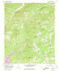
~ Sumter West SC topo map, 1:24000 scale, 7.5 X 7.5 Minute, Historical, 1961, updated 1981
Sumter West, South Carolina, USGS topographic map dated 1961.
Includes geographic coordinates (latitude and longitude). This topographic map is suitable for hiking, camping, and exploring, or framing it as a wall map.
Printed on-demand using high resolution imagery, on heavy weight and acid free paper, or alternatively on a variety of synthetic materials.
Topos available on paper, Waterproof, Poly, or Tyvek. Usually shipping rolled, unless combined with other folded maps in one order.
- Product Number: USGS-5388362
- Free digital map download (high-resolution, GeoPDF): Sumter West, South Carolina (file size: 15 MB)
- Map Size: please refer to the dimensions of the GeoPDF map above
- Weight (paper map): ca. 55 grams
- Map Type: POD USGS Topographic Map
- Map Series: HTMC
- Map Verison: Historical
- Cell ID: 43776
- Scan ID: 261619
- Imprint Year: 1981
- Woodland Tint: Yes
- Photo Revision Year: 1980
- Aerial Photo Year: 1977
- Edit Year: 1980
- Field Check Year: 1961
- Datum: NAD27
- Map Projection: Polyconic
- Map published by United States Geological Survey
- Map Language: English
- Scanner Resolution: 600 dpi
- Map Cell Name: Sumter West
- Grid size: 7.5 X 7.5 Minute
- Date on map: 1961
- Map Scale: 1:24000
- Geographical region: South Carolina, United States
Neighboring Maps:
All neighboring USGS topo maps are available for sale online at a variety of scales.
Spatial coverage:
Topo map Sumter West, South Carolina, covers the geographical area associated the following places:
- North Deerfield - Sunset Homes - Cartley Subdivision - Summer View - Beckwood - Carolina Mobile Home Park - Bon Air Terrace - Millwood - Hearthstone - Windsor City Mobile Home Park - Cherryvale - Shady Grove - Beckridge Park - Twin Lakes - Winter Park - Avondale - General Sumter Estates - Austin Acres - Pinckney Crossroad - Dinkins - Sunway Knolls - Oakland - Edgewater - Home Acres - Bradford - Oak Haven Acres - Bay Springs - Westhaven - Rainbow Falls - Warwick Estates - The Village Subdivision - Ashley Creek Village - Azalea Trailer Park - Curtis Park - East Sunway Knolls - Shaw Heights - Millwood Gardens - Sellars Heights - Hilldale - West Ridge - Idlewood - Audubon Park - Causeway Branch - Sanders Subdivision - Wedgewood Grove - Deerfield - Marden Ranchettes - Cane Savannah - Spring Lake - Swinton - Park West
- Map Area ID: AREA3433.875-80.5-80.375
- Northwest corner Lat/Long code: USGSNW34-80.5
- Northeast corner Lat/Long code: USGSNE34-80.375
- Southwest corner Lat/Long code: USGSSW33.875-80.5
- Southeast corner Lat/Long code: USGSSE33.875-80.375
- Northern map edge Latitude: 34
- Southern map edge Latitude: 33.875
- Western map edge Longitude: -80.5
- Eastern map edge Longitude: -80.375


