
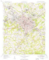
~ Spartanburg SC topo map, 1:24000 scale, 7.5 X 7.5 Minute, Historical, 1949
Spartanburg, South Carolina, USGS topographic map dated 1949.
Includes geographic coordinates (latitude and longitude). This topographic map is suitable for hiking, camping, and exploring, or framing it as a wall map.
Printed on-demand using high resolution imagery, on heavy weight and acid free paper, or alternatively on a variety of synthetic materials.
Topos available on paper, Waterproof, Poly, or Tyvek. Usually shipping rolled, unless combined with other folded maps in one order.
- Product Number: USGS-5388284
- Free digital map download (high-resolution, GeoPDF): Spartanburg, South Carolina (file size: 15 MB)
- Map Size: please refer to the dimensions of the GeoPDF map above
- Weight (paper map): ca. 55 grams
- Map Type: POD USGS Topographic Map
- Map Series: HTMC
- Map Verison: Historical
- Cell ID: 42427
- Scan ID: 261576
- Woodland Tint: Yes
- Visual Version Number: 2
- Aerial Photo Year: 1944
- Survey Year: 1947
- Datum: NAD27
- Map Projection: Polyconic
- Map published by United States Army Corps of Engineers
- Map Language: English
- Scanner Resolution: 600 dpi
- Map Cell Name: Spartanburg
- Grid size: 7.5 X 7.5 Minute
- Date on map: 1949
- Map Scale: 1:24000
- Geographical region: South Carolina, United States
Neighboring Maps:
All neighboring USGS topo maps are available for sale online at a variety of scales.
Spatial coverage:
Topo map Spartanburg, South Carolina, covers the geographical area associated the following places:
- Saxon - Woodburn Hills - Pinedale Acres - Whitney - West View - Evans Acres - Frady's Mobile Home Park - Hillcrest - Chelsea Mobile Home Park - Hub City Courts - Kenwood - Andrews Farms - Woodwind - Raynell - Carlton Court - Raintree - Shannon Forest - Spartanburg - Pinewood South - Fairview Heights - Salem Estates - Oak Forest - Branyon Heights - Camelot - Montgomery Acres - Sheffield - Arcadia Heights - Allen Acres - Roebuck - Canaan - Ridgewood Heights - Summerhill - Pebblebrook - Springdale - Arcadia - Ben Avon - South Meadows Farms - Byron Terrace - Heatherwood Mobile Home Park - Windsor Forest - Oak Hurst - Hartwell Courts - Lone Oak - Una - Drayton - Arkwright - Southport Estates - Converse Heights - Little Vista Heights - Park Hills - Washington Heights - Lakeview Mobile Home Park - Whitney Heights - Wadsworth - Stone Haven Mobile Home Park - Phyllis Goins Court - Hilltop - Southern Shops - Hayne Station - Glenwood (historical) - Johnson City - Delmar - Countryside Mobile Home Park - Hillbrook Forest - Vanderbilt Hills - East Spartanburg - Lanier Heights - Lawson - Farmfields - Fernwood Farms - Woodland Heights - Lakewood Mobile Home Park - Sherwood Acres - Anglewood - Hidden Hills - Anchor Mobile Home Park - Oasis Trailer Park - Belvedere
- Map Area ID: AREA3534.875-82-81.875
- Northwest corner Lat/Long code: USGSNW35-82
- Northeast corner Lat/Long code: USGSNE35-81.875
- Southwest corner Lat/Long code: USGSSW34.875-82
- Southeast corner Lat/Long code: USGSSE34.875-81.875
- Northern map edge Latitude: 35
- Southern map edge Latitude: 34.875
- Western map edge Longitude: -82
- Eastern map edge Longitude: -81.875


