
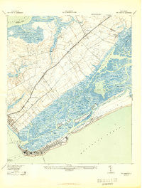
~ Fort Moultrie SC topo map, 1:24000 scale, 7.5 X 7.5 Minute, Historical, 1943
Fort Moultrie, South Carolina, USGS topographic map dated 1943.
Includes geographic coordinates (latitude and longitude). This topographic map is suitable for hiking, camping, and exploring, or framing it as a wall map.
Printed on-demand using high resolution imagery, on heavy weight and acid free paper, or alternatively on a variety of synthetic materials.
Topos available on paper, Waterproof, Poly, or Tyvek. Usually shipping rolled, unless combined with other folded maps in one order.
- Product Number: USGS-5387186
- Free digital map download (high-resolution, GeoPDF): Fort Moultrie, South Carolina (file size: 11 MB)
- Map Size: please refer to the dimensions of the GeoPDF map above
- Weight (paper map): ca. 55 grams
- Map Type: POD USGS Topographic Map
- Map Series: HTMC
- Map Verison: Historical
- Cell ID: 15963
- Scan ID: 261008
- Aerial Photo Year: 1941
- Survey Year: 1918
- Datum: NAD27
- Map Projection: Polyconic
- Map published by United States Army Corps of Engineers
- Map published by United States Department of War
- Map Language: English
- Scanner Resolution: 600 dpi
- Map Cell Name: Fort Moultrie
- Grid size: 7.5 X 7.5 Minute
- Date on map: 1943
- Map Scale: 1:24000
- Geographical region: South Carolina, United States
Neighboring Maps:
All neighboring USGS topo maps are available for sale online at a variety of scales.
Spatial coverage:
Topo map Fort Moultrie, South Carolina, covers the geographical area associated the following places:
- Avian Park - The Village - Parish Place - Moultrie Heights - Waterway Arms - Myrtle Acres - Wando Estates - Shemwood - Palmetto Fort - Snowden - Sullivans Island - Island of Palms - Porcher Bluff - Mount Pleasant - Point Pleasant - Isle of Palms - Heritage - Fort Moultrie - Cassina Heights - Creekside Park - Osceola Oaks - Moss Park - Seaside Farms Estates - Harborgate - Forest Trail - Osceola Heights - Brook Green Meadow - Somerset Point - Hickory Shadows
- Map Area ID: AREA32.87532.75-79.875-79.75
- Northwest corner Lat/Long code: USGSNW32.875-79.875
- Northeast corner Lat/Long code: USGSNE32.875-79.75
- Southwest corner Lat/Long code: USGSSW32.75-79.875
- Southeast corner Lat/Long code: USGSSE32.75-79.75
- Northern map edge Latitude: 32.875
- Southern map edge Latitude: 32.75
- Western map edge Longitude: -79.875
- Eastern map edge Longitude: -79.75


