
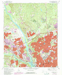
~ Columbia North SC topo map, 1:24000 scale, 7.5 X 7.5 Minute, Historical, 1972, updated 1990
Columbia North, South Carolina, USGS topographic map dated 1972.
Includes geographic coordinates (latitude and longitude). This topographic map is suitable for hiking, camping, and exploring, or framing it as a wall map.
Printed on-demand using high resolution imagery, on heavy weight and acid free paper, or alternatively on a variety of synthetic materials.
Topos available on paper, Waterproof, Poly, or Tyvek. Usually shipping rolled, unless combined with other folded maps in one order.
- Product Number: USGS-5386948
- Free digital map download (high-resolution, GeoPDF): Columbia North, South Carolina (file size: 17 MB)
- Map Size: please refer to the dimensions of the GeoPDF map above
- Weight (paper map): ca. 55 grams
- Map Type: POD USGS Topographic Map
- Map Series: HTMC
- Map Verison: Historical
- Cell ID: 9693
- Scan ID: 260889
- Imprint Year: 1990
- Woodland Tint: Yes
- Photo Revision Year: 1990
- Aerial Photo Year: 1988
- Edit Year: 1990
- Field Check Year: 1972
- Survey Year: 1947
- Datum: NAD27
- Map Projection: Polyconic
- Map published by United States Geological Survey
- Map Language: English
- Scanner Resolution: 600 dpi
- Map Cell Name: Columbia North
- Grid size: 7.5 X 7.5 Minute
- Date on map: 1972
- Map Scale: 1:24000
- Geographical region: South Carolina, United States
Neighboring Maps:
All neighboring USGS topo maps are available for sale online at a variety of scales.
Spatial coverage:
Topo map Columbia North, South Carolina, covers the geographical area associated the following places:
- Eau Claire - Dutchbrook - Baronywood - Homewood Terrace - Jaggers Terrace - Frost - Denny Terrace - Riverbanks - Westover Acres - Northgate - Pine Valley - Emerald Valley - Columbia - Hollywood Hills - Haskell Heights - Saint Andrews - West Chester - Apple Valley - Saluda Terrace - Meadow Lake - Belleview - Barony - Belmont Estates - Quail Hollow - Broad River Estates - Chartwell - Forest Hills - Brook Pines - Colonial Heights - Byrneswood - Kingswood - Evergreen Park - Belmont - Dutch Square - Dunston Hills - Lincolnshire - Fairfield Terrace - Riverview Terrace - Elm Abode - Waverly - Booker Washington Heights - Hyatts - Saxton Homes - Brockington Heights - Mandel Hall - Cross Roads - Westwood Hills - Saluda River Estates - Melrose Heights - Allen Benedict Court - Saluda Gardens - Elmwood - Fairfield Arms - Munster - Barhamville Estates - Saluda Hills - Rockgate - North Twenty One Terrace - Mandel Park - Pine Forest - Arlington Estates - Butchertown (historical) - Park Place West - Riverside Forest - Latimer Manor - Highland Forest - Crane Forest
- Map Area ID: AREA34.12534-81.125-81
- Northwest corner Lat/Long code: USGSNW34.125-81.125
- Northeast corner Lat/Long code: USGSNE34.125-81
- Southwest corner Lat/Long code: USGSSW34-81.125
- Southeast corner Lat/Long code: USGSSE34-81
- Northern map edge Latitude: 34.125
- Southern map edge Latitude: 34
- Western map edge Longitude: -81.125
- Eastern map edge Longitude: -81


