
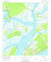
~ Bluffton SC topo map, 1:24000 scale, 7.5 X 7.5 Minute, Historical, 1956, updated 1976
Bluffton, South Carolina, USGS topographic map dated 1956.
Includes geographic coordinates (latitude and longitude). This topographic map is suitable for hiking, camping, and exploring, or framing it as a wall map.
Printed on-demand using high resolution imagery, on heavy weight and acid free paper, or alternatively on a variety of synthetic materials.
Topos available on paper, Waterproof, Poly, or Tyvek. Usually shipping rolled, unless combined with other folded maps in one order.
- Product Number: USGS-5386730
- Free digital map download (high-resolution, GeoPDF): Bluffton, South Carolina (file size: 11 MB)
- Map Size: please refer to the dimensions of the GeoPDF map above
- Weight (paper map): ca. 55 grams
- Map Type: POD USGS Topographic Map
- Map Series: HTMC
- Map Verison: Historical
- Cell ID: 4603
- Scan ID: 260772
- Imprint Year: 1976
- Woodland Tint: Yes
- Photo Revision Year: 1971
- Aerial Photo Year: 1971
- Survey Year: 1956
- Datum: NAD27
- Map Projection: Polyconic
- Map published by United States Geological Survey
- Map Language: English
- Scanner Resolution: 600 dpi
- Map Cell Name: Bluffton
- Grid size: 7.5 X 7.5 Minute
- Date on map: 1956
- Map Scale: 1:24000
- Geographical region: South Carolina, United States
Neighboring Maps:
All neighboring USGS topo maps are available for sale online at a variety of scales.
Spatial coverage:
Topo map Bluffton, South Carolina, covers the geographical area associated the following places:
- Bryan Landing - Bay Pines - Harbour Town - Horse Landing - Spanish Wells - Myrtle Island - Brighton Beach - Greenwood Forest - Lawton - Bluffton - Cooper River Landing - Heritage Woods - Hickory Bluff - Fairway Oaks - Buckingham Landing - Wexford Plantation - Sea Pines Plantation - Hilton Head Island - Calibogue Cay - Point Comfort - Sea Pines Circle - Windmill Harbor - Point Comfort Woods - Sea Pines - Opossum Point Landing
- Map Area ID: AREA32.2532.125-80.875-80.75
- Northwest corner Lat/Long code: USGSNW32.25-80.875
- Northeast corner Lat/Long code: USGSNE32.25-80.75
- Southwest corner Lat/Long code: USGSSW32.125-80.875
- Southeast corner Lat/Long code: USGSSE32.125-80.75
- Northern map edge Latitude: 32.25
- Southern map edge Latitude: 32.125
- Western map edge Longitude: -80.875
- Eastern map edge Longitude: -80.75


