
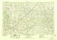
~ Tucumcari NM topo map, 1:250000 scale, 1 X 2 Degree, Historical, 1958, updated 1958
Tucumcari, New Mexico, USGS topographic map dated 1958.
Includes geographic coordinates (latitude and longitude). This topographic map is suitable for hiking, camping, and exploring, or framing it as a wall map.
Printed on-demand using high resolution imagery, on heavy weight and acid free paper, or alternatively on a variety of synthetic materials.
Topos available on paper, Waterproof, Poly, or Tyvek. Usually shipping rolled, unless combined with other folded maps in one order.
- Product Number: USGS-5386552
- Free digital map download (high-resolution, GeoPDF): Tucumcari, New Mexico (file size: 17 MB)
- Map Size: please refer to the dimensions of the GeoPDF map above
- Weight (paper map): ca. 55 grams
- Map Type: POD USGS Topographic Map
- Map Series: HTMC
- Map Verison: Historical
- Cell ID: 69062
- Scan ID: 193393
- Imprint Year: 1958
- Woodland Tint: Yes
- Aerial Photo Year: 1954
- Field Check Year: 1954
- Datum: Unstated
- Map Projection: Transverse Mercator
- Map published by United States Geological Survey
- Map Language: English
- Scanner Resolution: 600 dpi
- Map Cell Name: Tucumcari
- Grid size: 1 X 2 Degree
- Date on map: 1958
- Map Scale: 1:250000
- Geographical region: New Mexico, United States
Neighboring Maps:
All neighboring USGS topo maps are available for sale online at a variety of scales.
Spatial coverage:
Topo map Tucumcari, New Mexico, covers the geographical area associated the following places:
- Wimberly Place - Pleasant Valley (historical) - Strip Crossing - Hargis - Bueyeros - Mosquero - Rain Place - Hendricks Place - Palomas - Rosebud Farms - Centerville - Everett - King - Bautista - Knoblaw - Hanley (historical) - Glenrio - Ford - Brown Place - Frio (historical) - Bunk Clay Place - Adrian - Boden - Romero - Lesbia - Tascosa - Amistad - San Jon - Middlewell - Sand Springs - Woods Place - Campana - Logan - Sabino - Hayden - Porter - Bates Place - Gallegos - Wildorado - Ady - Twin Mill - Landergin - Rosebud - Endee - Stallwitz Lake - Canode (historical) - Simms - Corner Windmill - Hartley - Bushland - Old Farm Crossing - Centerville Corner - Bard - Obar - Vega - Middle Water - Nara Visa - Gruhlkey - Cummings Place - Hudson - Partwood Crossing - Tucumcari - Anniston (historical) - Channing - Albert - Hollicott Crossing - Boise - Boys Ranch - Allen (historical) - Murdo - Rehm - Old Tascosa (historical)
- Map Area ID: AREA3635-104-102
- Northwest corner Lat/Long code: USGSNW36-104
- Northeast corner Lat/Long code: USGSNE36-102
- Southwest corner Lat/Long code: USGSSW35-104
- Southeast corner Lat/Long code: USGSSE35-102
- Northern map edge Latitude: 36
- Southern map edge Latitude: 35
- Western map edge Longitude: -104
- Eastern map edge Longitude: -102


