
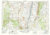
~ Socorro NM topo map, 1:250000 scale, 1 X 2 Degree, Historical, 1954, updated 1981
Socorro, New Mexico, USGS topographic map dated 1954.
Includes geographic coordinates (latitude and longitude). This topographic map is suitable for hiking, camping, and exploring, or framing it as a wall map.
Printed on-demand using high resolution imagery, on heavy weight and acid free paper, or alternatively on a variety of synthetic materials.
Topos available on paper, Waterproof, Poly, or Tyvek. Usually shipping rolled, unless combined with other folded maps in one order.
- Product Number: USGS-5386546
- Free digital map download (high-resolution, GeoPDF): Socorro, New Mexico (file size: 19 MB)
- Map Size: please refer to the dimensions of the GeoPDF map above
- Weight (paper map): ca. 55 grams
- Map Type: POD USGS Topographic Map
- Map Series: HTMC
- Map Verison: Historical
- Cell ID: 69035
- Scan ID: 193104
- Imprint Year: 1981
- Woodland Tint: Yes
- Aerial Photo Year: 1954
- Edit Year: 1970
- Field Check Year: 1954
- Datum: NAD27
- Map Projection: Transverse Mercator
- Map published by United States Geological Survey
- Map Language: English
- Scanner Resolution: 600 dpi
- Map Cell Name: Socorro
- Grid size: 1 X 2 Degree
- Date on map: 1954
- Map Scale: 1:250000
- Geographical region: New Mexico, United States
Neighboring Maps:
All neighboring USGS topo maps are available for sale online at a variety of scales.
Spatial coverage:
Topo map Socorro, New Mexico, covers the geographical area associated the following places:
- Valencia - Chilili - Alexander Place - McIntosh - Peralta - Candelaria Place - Bodega - Red Mill - Pajarito - Canyon del Rio - Martin Place - Old Chilili - Los Lunas - Belen - Acoma Pueblo - Tome - Torreon - Payne Place - Augustine - Barr - Pine Springs - Tajique - Pasitos del Cielo - Becker - E Davis Place - Gutierrezville - C Davis Place - Jarales - Willard - Lemitar - San Geronimo - Romero Place - Tajo (historical) - Hyde Place - Bacaville - Mountainair - Datil - Los Chavez - El Cerro - La Joyita (historical) - McKinley Place - Pueblitos - Broncho - John Padilla Settlement - Roundtop (historical) - Alley Place - Moriarty - Meadow Lake - McCord Place - Bermadez Place - Rio Puerco - Los Trujillos - Sandia - Adelino - Dunn Place - Pino Place - Isleta - Rio del Oro - South Garcia - Mountainview - Suwanee - Scholle - Rio Communities - Glover Place - Witt - Los Lentes - Gran Quivira - Riley Place - Chato - Alamo - Punta de Agua - Paquita - Moorehead Place - Augustine (historical) - McNierney - Nelson Place - Bosque - Manzano - Antelope Springs - La Ladera - La Constancia - Anderson Place - Monterey Park - Maez Place - Correo - Webster Place - Azul - Bosque Farms - Riley - Chical - La Cienega - Romero Place - Benson Place - Acoma Village - Los Chavez - Los Padillas - Polvadera - Sanchez Place - Estancia - Gibbs Place
- Map Area ID: AREA3534-108-106
- Northwest corner Lat/Long code: USGSNW35-108
- Northeast corner Lat/Long code: USGSNE35-106
- Southwest corner Lat/Long code: USGSSW34-108
- Southeast corner Lat/Long code: USGSSE34-106
- Northern map edge Latitude: 35
- Southern map edge Latitude: 34
- Western map edge Longitude: -108
- Eastern map edge Longitude: -106


