
~ Santa Fe NM topo map, 1:250000 scale, 1 X 2 Degree, Historical, 1954, updated 1976
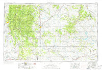
Santa Fe, New Mexico, USGS topographic map dated 1954.
Includes geographic coordinates (latitude and longitude). This topographic map is suitable for hiking, camping, and exploring, or framing it as a wall map.
Printed on-demand using high resolution imagery, on heavy weight and acid free paper, or alternatively on a variety of synthetic materials.
Topos available on paper, Waterproof, Poly, or Tyvek. Usually shipping rolled, unless combined with other folded maps in one order.
- Product Number: USGS-5386510
- Free digital map download (high-resolution, GeoPDF): Santa Fe, New Mexico (file size: 18 MB)
- Map Size: please refer to the dimensions of the GeoPDF map above
- Weight (paper map): ca. 55 grams
- Map Type: POD USGS Topographic Map
- Map Series: HTMC
- Map Verison: Historical
- Cell ID: 69017
- Scan ID: 192281
- Imprint Year: 1976
- Woodland Tint: Yes
- Aerial Photo Year: 1954
- Edit Year: 1962
- Field Check Year: 1954
- Datum: Unstated
- Map Projection: Transverse Mercator
- Map published by United States Geological Survey
- Map Language: English
- Scanner Resolution: 600 dpi
- Map Cell Name: Santa Fe
- Grid size: 1 X 2 Degree
- Date on map: 1954
- Map Scale: 1:250000
- Geographical region: New Mexico, United States
Neighboring Maps:
All neighboring USGS topo maps are available for sale online at a variety of scales.
Spatial coverage:
Topo map Santa Fe, New Mexico, covers the geographical area associated the following places:
- Villanueva - Lagunita - Upper La Posada - San Ramon - La Cueva - Ledoux - Alamito - Hot Springs - Ojita - Llano Viejo - East Las Vegas (historical) - Peñasco Blanco - Montezuma - Gallinas - Clines Corners - Nambe Pueblo - Las Dispensas - Cedar Hill - Spiess - Armenta Plaza (historical) - Colonias - Sabinoso - Lower La Posada - San Antonio - Corazon (historical) - Sapello - Upper Colonias - Geronimo - Trout Springs - Romero - El Macho - Analco (historical) - Sanchez - Los Montoyas - White Lakes (historical) - Lower Pueblo - Gascon - Shoemaker - Kennedy - Dahlia - Rainsville - Montoya - Trujillo - Las Vegas - Tererro - Sheridan - Newkirk - San Jose - San Augustin - Pajarita - Lagunas - New Trementina - Seton Village - Santa Fe - El Llano - Cowles - Golondrinas - Cuervo - Jack Canon Place - En Medio - South San Ysidro - Ciruela - Montosa - Aurora - El Dorado at Santa Fe - Pinos Altos - Winsor Creek Summer Home - Gabaldon - Monte Aplanado - Las Tusas - Valmora - Tesuque Pueblo - Lower Colonias - Roy - Gonzales Ranch - Cundiyo - San Pablo - San Ignacio - Escondillo - Rencona - South Carmen - Potrero - Rio En Medio - Eldorado at Santa Fe - Tierra Monte - Chaperito - Double Mills - Tecolote - Santa Gertrudis (historical) - La Liendre - Chapelle - Young Place - Tecolotito - Ojitos Frios - Blanchard - Upper Rociada - El Dorado - East Pecos - San Geronimo - Loma Parda
- Map Area ID: AREA3635-106-104
- Northwest corner Lat/Long code: USGSNW36-106
- Northeast corner Lat/Long code: USGSNE36-104
- Southwest corner Lat/Long code: USGSSW35-106
- Southeast corner Lat/Long code: USGSSE35-104
- Northern map edge Latitude: 36
- Southern map edge Latitude: 35
- Western map edge Longitude: -106
- Eastern map edge Longitude: -104


