
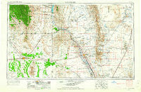
~ Las Cruces NM topo map, 1:250000 scale, 1 X 2 Degree, Historical, 1955, updated 1963
Las Cruces, New Mexico, USGS topographic map dated 1955.
Includes geographic coordinates (latitude and longitude). This topographic map is suitable for hiking, camping, and exploring, or framing it as a wall map.
Printed on-demand using high resolution imagery, on heavy weight and acid free paper, or alternatively on a variety of synthetic materials.
Topos available on paper, Waterproof, Poly, or Tyvek. Usually shipping rolled, unless combined with other folded maps in one order.
- Product Number: USGS-5386478
- Free digital map download (high-resolution, GeoPDF): Las Cruces, New Mexico (file size: 17 MB)
- Map Size: please refer to the dimensions of the GeoPDF map above
- Weight (paper map): ca. 55 grams
- Map Type: POD USGS Topographic Map
- Map Series: HTMC
- Map Verison: Historical
- Cell ID: 72235
- Scan ID: 191243
- Imprint Year: 1963
- Woodland Tint: Yes
- Aerial Photo Year: 1948
- Edit Year: 1962
- Field Check Year: 1954
- Datum: Unstated
- Map Projection: Transverse Mercator
- Map published by United States Geological Survey
- Map Language: English
- Scanner Resolution: 600 dpi
- Map Cell Name: Las Cruces
- Grid size: 1 X 2 Degree
- Date on map: 1955
- Map Scale: 1:250000
- Geographical region: New Mexico, United States
Neighboring Maps:
All neighboring USGS topo maps are available for sale online at a variety of scales.
Spatial coverage:
Topo map Las Cruces, New Mexico, covers the geographical area associated the following places:
- San Ysidro - Orogrande - Mesquite - Leasburg - Salem - Hacienda Acres - Caballo - Peruhill - San Pablo - Rodey - La Mesa - Mesilla - Organ - Tunis - Vado - Mesilla Park - Nutt - Oasis - White Sands - Tonuco - Hersey Place - Akela - Kingston - Monista (historical) - Upham - Grama - Las Cruces - Chaparral - Hill - Fairacres - Sunshine - Dwyer - Big Mill - Derry - Santo Tomas - Fort Selden - Rincon - Turquoise - Spalding - Deming - Mirage - Alivio - Cambray - Newman - Placitas - Point of Sands - Florida - Rutter - Lake Valley - Garfield - San Miguel - Four Points - Chaparral - Mimbres - Doña Ana - Alvarado - Boyd - Old Town - Hillsboro - Picacho - Elwood - Chamberino - Eller Place - Myndus - Mountain View - Afton - Berino - San Lorenzo - Angostura - Arrey - Spaceport City - Kenzin - Kimball Place - Aden - University Park - El Ojito - Tortugas - Carne - Anthony - Chappel - Modoc (historical) - Pronto - Sherman - Hockett - San Juan - Radium Springs - Hatch
- Map Area ID: AREA3332-108-106
- Northwest corner Lat/Long code: USGSNW33-108
- Northeast corner Lat/Long code: USGSNE33-106
- Southwest corner Lat/Long code: USGSSW32-108
- Southeast corner Lat/Long code: USGSSE32-106
- Northern map edge Latitude: 33
- Southern map edge Latitude: 32
- Western map edge Longitude: -108
- Eastern map edge Longitude: -106


