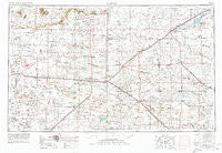
~ Clovis NM topo map, 1:250000 scale, 1 X 2 Degree, Historical, 1954, updated 1980
Clovis, New Mexico, USGS topographic map dated 1954.
Includes geographic coordinates (latitude and longitude). This topographic map is suitable for hiking, camping, and exploring, or framing it as a wall map.
Printed on-demand using high resolution imagery, on heavy weight and acid free paper, or alternatively on a variety of synthetic materials.
Topos available on paper, Waterproof, Poly, or Tyvek. Usually shipping rolled, unless combined with other folded maps in one order.
- Product Number: USGS-5386448
- Free digital map download (high-resolution, GeoPDF): Clovis, New Mexico (file size: 16 MB)
- Map Size: please refer to the dimensions of the GeoPDF map above
- Weight (paper map): ca. 55 grams
- Map Type: POD USGS Topographic Map
- Map Series: HTMC
- Map Verison: Historical
- Cell ID: 68722
- Scan ID: 190237
- Imprint Year: 1980
- Woodland Tint: Yes
- Aerial Photo Year: 1972
- Edit Year: 1973
- Datum: NAD27
- Map Projection: Transverse Mercator
- Map published by United States Geological Survey
- Map Language: English
- Scanner Resolution: 600 dpi
- Map Cell Name: Clovis
- Grid size: 1 X 2 Degree
- Date on map: 1954
- Map Scale: 1:250000
- Geographical region: New Mexico, United States
Neighboring Maps:
All neighboring USGS topo maps are available for sale online at a variety of scales.
Spatial coverage:
Topo map Clovis, New Mexico, covers the geographical area associated the following places:
- Progress - Midway - Puerto (historical) - Floyd - Cameo - Ranchvale - Sunnyside - Fieldton - Ragland - Upton - Krider - Mulkey - Lariat - Grier - Tinsley Crossing - Arney - Dawn - Clays Corner - Parmerton - Ogle (historical) - Umbarger - Westway - Baileyboro - Sudan - Roy - Delphos - Cowan (historical) - Clovis - Nazareth - Ingram (historical) - Needmore - Easter - Field - Yerba - Oklahoma Lane - Broadview - Joel - Springlake - Hart Camp - Jumbo - Jordan - Ford (historical) - Hub - Corry - Summerfield - Milo Center - Fairview - Kirk (historical) - Rhea - Bovina - Grady - Wheatland - Farwell - Muleshoe - Earth - Eiland (historical) - Cofferville - Hart - Norton - Benson (historical) - Flagg - Amherst - Black - Forrest - Wilsey - Gallaher - Quay - Weber City - Circleback - Arch - Friona - Circle - Frio - Dodd - Olton - McAlister - Cantara - Saint Vrain - Tam Anne - Lazbuddie - Texico - Melrose - Bethel - Dimmitt - Portales - Pleasant Valley - Tolar - Bootleg - Plain (historical) - Stegall - Bellview - Hollene - Hilburn - House - Pleasant Hill - Big Square - Portair - Kermit - Hereford - Walcott
- Map Area ID: AREA3534-104-102
- Northwest corner Lat/Long code: USGSNW35-104
- Northeast corner Lat/Long code: USGSNE35-102
- Southwest corner Lat/Long code: USGSSW34-104
- Southeast corner Lat/Long code: USGSSE34-102
- Northern map edge Latitude: 35
- Southern map edge Latitude: 34
- Western map edge Longitude: -104
- Eastern map edge Longitude: -102

